UpToWhere
What can you see from Mount Baker?
A glacier-mantled volcano crowning the North Cascades.
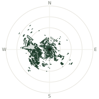
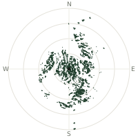
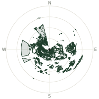
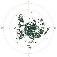
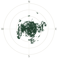
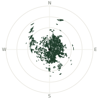
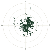
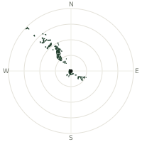
From Mount Baker, the terrain-limited line of sight reaches up to 292 km. The single farthest piece of visible terrain lies 292 km to the west-northwest (bearing 294°), at 1,681 m elevation. These results account for Earth's curvature and standard atmospheric refraction, computed from 30-meter resolution Copernicus GLO-30 elevation data across 2,372,961 terrain samples.
Open the interactive visibility map →Visibility by direction
The horizon is most open toward the south-southwest, where sightlines run 242 km on average; terrain closes the view down fastest to the northwest, at 48.6 km.
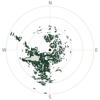
| N | 150 km | |
| NNE | 131 km | |
| NE | 109 km | |
| ENE | 125 km | |
| E | 108 km | |
| ESE | 96.2 km | |
| SE | 101 km | |
| SSE | 146 km | |
| S | 225 km | |
| SSW | 242 km | |
| SW | 161 km | |
| WSW | 184 km | |
| W | 177 km | |
| WNW | 145 km | |
| NW | 48.6 km | |
| NNW | 160 km |
Farthest named landmarks in view
829 named peaks, hills and headlands stand inside this viewshed. These are the farthest ones you could pick out on a clear day:
| Landmark | Visible distance | Direction | Elevation |
|---|---|---|---|
| East Dome | 288 km | S · 185° | 1,610 m |
| Dogs Head | 288 km | S · 185° | 2,489 m |
| False Summit (historical) | 288 km | S · 186° | 1,904 m |
| Pumice Butte | 287 km | S · 185° | 1,351 m |
| Mount Adams | 287 km | S · 175° | 3,745 m |
| Goat Butte | 287 km | S · 174° | 2,260 m |
About Mount Baker
Mount Baker rises 3,286 meters in Washington's North Cascades as an active andesitic stratovolcano. Exceptionally glaciated with eleven named glaciers, it carries more ice than all other Cascade volcanoes except Mount Rainier. Current trends suggest glaciers may vanish by 2055-2075.
Did you know?
- Elevation 10,781 feet (3,286 meters); active glacier-covered stratovolcano.
- Eleven named glaciers descend from summit; most heavily glaciated Cascade peak except Rainier.
- Coleman Glacier largest; surface area 1,285 acres with volume 0.43 cubic miles.
- Glaciers estimated to disappear around 2055-2075 due to global warming trends.
Frequently asked questions
How far can you see from Mount Baker?
On a clear day the terrain allows a line of sight of up to 292 km from Mount Baker. The average visible distance across all 360 directions is 144 km. Atmospheric conditions (haze, humidity) usually reduce practical visibility below the terrain-limited maximum.
What is the farthest point visible from Mount Baker?
The farthest terrain visible from Mount Baker lies 292 km to the west-northwest, at an elevation of 1,681 m. Earth's curvature and atmospheric refraction are accounted for in this calculation.
How high is Mount Baker?
The observation point at Mount Baker sits at 3,280 m above sea level (Copernicus GLO-30 elevation model).
How is this visibility map calculated?
UpToWhere traces lines of sight in 360 directions from the observer using 30 m-resolution Copernicus terrain data, correcting for Earth curvature and standard atmospheric refraction. You can run the same analysis for any point on Earth with the free calculator.
Run your own analysis
Want to know what you can see from your house, a summit you're planning to climb, or a plot of land? UpToWhere computes the same 360° viewshed for any point on Earth in seconds — free.
Try the viewshed calculator