UpToWhere
What can you see from Mount Adams?
Washington's largest stratovolcano, yet its summit spread is so gentle it was mistaken for lost height.
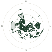
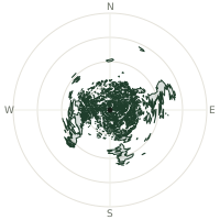
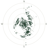
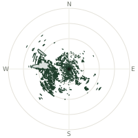
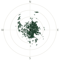
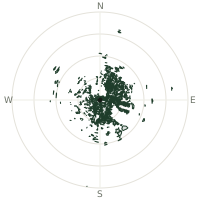
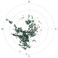
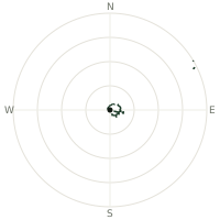
From Mount Adams, the terrain-limited line of sight reaches up to 344 km. The single farthest piece of visible terrain lies 344 km to the east-southeast (bearing 107°), at 2,884 m elevation. These results account for Earth's curvature and standard atmospheric refraction, computed from 30-meter resolution Copernicus GLO-30 elevation data across 2,423,873 terrain samples.
Open the interactive visibility map →Visibility by direction
The horizon is most open toward the east-southeast, where sightlines run 269 km on average; terrain closes the view down fastest to the north-northwest, at 148 km.
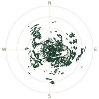
| N | 195 km | |
| NNE | 170 km | |
| NE | 209 km | |
| ENE | 225 km | |
| E | 262 km | |
| ESE | 269 km | |
| SE | 235 km | |
| SSE | 210 km | |
| S | 223 km | |
| SSW | 169 km | |
| SW | 240 km | |
| WSW | 181 km | |
| W | 166 km | |
| WNW | 175 km | |
| NW | 216 km | |
| NNW | 148 km |
Farthest named landmarks in view
988 named peaks, hills and headlands stand inside this viewshed. These are the farthest ones you could pick out on a clear day:
| Landmark | Visible distance | Direction | Elevation |
|---|---|---|---|
| Point Joseph | 344 km | ESE · 106° | 2,933 m |
| Flagstaff Point | 334 km | ESE · 107° | 2,500 m |
| China Cap | 331 km | ESE · 109° | 2,632 m |
| Strawberry Mountain | 303 km | SE · 133° | 2,750 m |
| Johnny George Mountain | 299 km | NE · 49° | 1,249 m |
| Elk Mountain | 298 km | SE · 134° | 2,138 m |
About Mount Adams
Mount Adams, at 12,276 feet, is Washington's second-highest peak and the largest stratovolcano in the state, built by separated lava and scoria cone vents rather than a single central vent. Its flat, sprawling summit area misled climbers into thinking the volcano had been decapitated, but geological study shows the broad crest formed naturally as the cone accumulated over time. Twelve named glaciers descend its slopes, feeding meltwater into the region's river systems.
Did you know?
- The Yakama people call the mountain Pahto and tell of it as one of several rival spirit-mountains in the Bridge of the Gods legend, alongside Hood and St. Helens.
- Its summit area spans nearly half a mile across, formed by cone-building eruptions from separated vents.
- False summit Pikers Peak rises 11,657 feet on the south side, the true summit 600 feet higher to the north.
- A sulfur mine once operated in the summit crater, with mule trains hauling ore down the mountain until the claim was abandoned in the 1950s.
- The mountain is the largest stratovolcano in Washington and second-largest in the entire Cascade Range.
Frequently asked questions
How far can you see from Mount Adams?
On a clear day the terrain allows a line of sight of up to 344 km from Mount Adams. The average visible distance across all 360 directions is 206 km. Atmospheric conditions (haze, humidity) usually reduce practical visibility below the terrain-limited maximum.
What is the farthest point visible from Mount Adams?
The farthest terrain visible from Mount Adams lies 344 km to the east-southeast, at an elevation of 2,884 m. Earth's curvature and atmospheric refraction are accounted for in this calculation.
How high is Mount Adams?
The observation point at Mount Adams sits at 3,749 m above sea level (Copernicus GLO-30 elevation model).
How is this visibility map calculated?
UpToWhere traces lines of sight in 360 directions from the observer using 30 m-resolution Copernicus terrain data, correcting for Earth curvature and standard atmospheric refraction. You can run the same analysis for any point on Earth with the free calculator.
Run your own analysis
Want to know what you can see from your house, a summit you're planning to climb, or a plot of land? UpToWhere computes the same 360° viewshed for any point on Earth in seconds — free.
Try the viewshed calculator