 UpToWhere
Qualify wireless links against real terrain, in seconds
Fresnel-checked path profiles, bulk customer qualification and solved mast heights, in the browser. No GIS, no credits.
See what Studio includes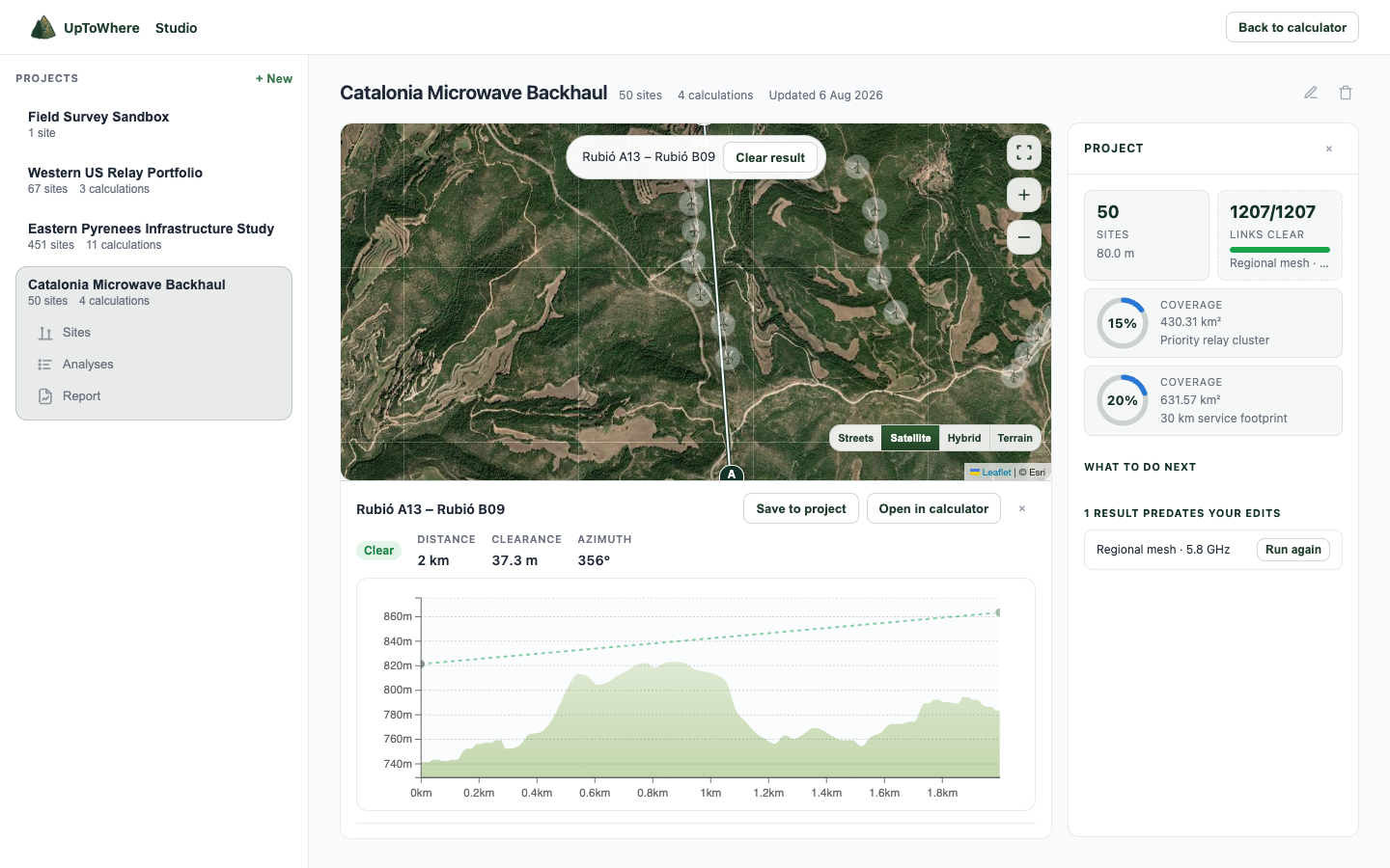
What Studio does for a WISP
Serviceability in seconds
Paste up to 500 customer locations as a CSV of coordinates and every one gets a clear, marginal or blocked verdict against your tower.
Raise to clear
A blocked link comes back with the exact mast height that clears it, at either end, plus the two-end trade-off curve.
Relay finder
The corridor between two blocked sites is searched for ground that provably sees both ends, ranked by required mast height.
Deliverables included
KML, GeoJSON, provenance-stamped CSV and a PDF report under your own name and logo. No per-export fees: TowerCoverage charges $100 per KML or shapefile export.
From a customer list to a report
| Step | You do | Studio returns |
|---|---|---|
| Import | Paste towers and customers as CSV, metres or feet | Up to 500 sites per file, round-tripped back out as CSV |
| Qualify | Run the matrix against your tower | Clear, marginal or blocked for every path, worst first, up to 1,500 links |
| Raise | Open a blocked row | The mast height that clears at either end, and the two-end trade-off |
| Relay | When no mast height is enough | Ground between the ends that sees both, ranked by required height |
| Hand over | Export | KML, GeoJSON, provenance CSV and a PDF with your name and logo on the cover and the methodology page inside |
Studio is 49€/month or 490€/year. No credits, no per-export fees, no quota. CloudRF Gold is £144/month for the comparable gate; TowerCoverage meters every export. What you export is yours.
What we deliberately do not do
No propagation prediction: no dBm, no link budgets, no coverage claims to a regulator. Studio answers what terrain decides: does the path clear, how high must the mast be, what does the tower see. For licensed-band engineering and NLOS gear, use an RF model.
FAQ
Is this a Fresnel zone calculator?
Yes, on the real path. A formula calculator gives you the first Fresnel radius at mid-path; Studio draws the whole ellipsoid along the terrain profile at your frequency, tests 60% clearance against every sample, and returns the mast height that clears it. Presets at 900 MHz, 2.4 GHz and 5.8 GHz, any frequency from 30 MHz to 100 GHz.
Does it work for Ubiquiti, Cambium or Mimosa links?
Any radio. The check is terrain and frequency, not vendor: set the frequency your gear uses and the path is judged the way the hardware will see it. Studio does not model the link budget, so pair it with the vendor calculator for throughput.
Is this an RF planning tool?
It is a terrain feasibility tool. It computes line of sight, Fresnel clearance by frequency and required antenna heights on real terrain. It deliberately does not model transmit power, antenna gain or receive sensitivity, so it complements an RF planning suite rather than replacing one for licensed work.
What terrain data does it use?
Copernicus GLO-30, a 30 m global surface model with stated sub-4 m vertical accuracy, named openly in every export. Because it is a surface model, vegetation and buildings are partly included in the heights. Verify marginal paths on site.
Can I import my towers and customers?
Yes. CSV import takes up to 500 rows per file with name, latitude, longitude and height, in metres or feet. Sites round-trip back out as CSV.
How is it priced?
One price: 49€/month or 490€/year. No credits, no per-report fees, no per-export fees, no quotas. What you export is yours to hand on, and yours to check. Cancel anytime.
Does it work in my country?
Coverage is worldwide, from 90°S to 90°N. The elevation model is global, so remote and rural paths work the same as urban ones.
Explore more Studio workflows
Studio is 49€/month, unmetered
Bulk runs, exports and reports, all included.
See what Studio includesAlready have Studio? Open it