 UpToWhere
ZTV maps in minutes, not a week
Cumulative visibility for turbines, solar sites and masts on bare-earth ground models, with standard radii, difference maps and GIS-ready exports.
See what Studio includes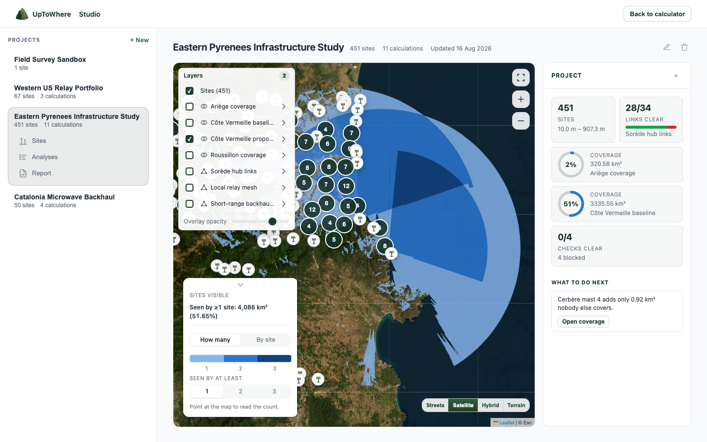
What Studio does for a ZTV
Bare-earth ground model
A ZTV is computed on bare ground, so that is what Studio runs it on: national bare-earth DTMs in England, France, the Netherlands, Norway, Poland, Spain, Italy and the USA, with Ordnance Survey Terrain 50 for the rest of Great Britain. It is the ZTV preset default, not a setting to go and find.
Cumulative, per cell
Up to 60 sites, each with its own height, under one study radius; the map counts how many are visible from every point in the study area.
Consented vs proposed
Load a baseline run and subtract it: newly visible, no longer affected, and net change render as one difference map.
Print map sheet
A cartographic PNG on our own terrain relief with scale bar, legend, north arrow and provenance stamp. No third-party tiles, no licensing chain.
From a layout to a map sheet
| Step | You do | Studio returns |
|---|---|---|
| Place sites | Turbines, panels or masts, each with its own height; one study radius per run | Up to 60 sites in one cumulative run |
| Run the ZTV | Pick 15, 30 or 45 km at a 2 m receptor, or set your own | A count map: how many sites are theoretically visible from every cell |
| Difference | Load the consented baseline and subtract | Newly visible, no longer affected, and net change on one map |
| Hand over | Export | Print sheet with scale, legend and north; GeoTIFF, KMZ and a PDF with methodology |
Studio is 49€/month or 490€/year. No credits, no per-map fees. What you export is yours.
What we deliberately do not do
No photomontages, no wirelines, no landscape character assessment. A ZTV is a screening figure computed on stated data with stated physics: curvature and refraction at the standard optical coefficient, dataset named on the output. The professional judgment around it is yours.
FAQ
Is the ZTV computed on bare ground or on a surface model?
Bare ground, where we have it. Guidance and practice both put a ZTV on a bare-ground DTM with a 2 m receptor, and that is what the ZTV preset selects: national bare-earth DTMs in eight countries. Outside them the fallback is Copernicus GLO-30, which is a surface model, so vegetation and buildings are partly in its heights. Whichever ran is named on the map sheet and in the methodology page, never left for you to assume.
ZTV or ZVI: is there a difference?
Not in the computation. Zone of theoretical visibility and zone of visual influence name the same bare-ground screening map; UK guidance settled on ZTV, older reports and some Irish and Scottish ones say ZVI. Studio labels the output ZTV, and you call it whatever your brief calls it.
Can I do this in QGIS instead?
Yes, one viewshed at a time: the QGIS visibility plugin and the ArcGIS Viewshed tool both work, and if you already have the DTM tiles and the workflow, keep using them. Studio is for the rest of the job: sixty sites in one run, the standard radii, bare-earth data already fetched and cited, a difference map against the consented layout, and the GeoTIFF and map sheet without a print composer.
Can I model blade tip and hub height separately?
Yes, by running the analysis at each height: site heights are per-site parameters, so a tip-height run and a hub-height run take a minute each. An automated paired tip/hub figure is on the roadmap.
Which radius conventions are built in?
Presets at 15, 30 and 45 km with a 2 m receptor height, matching common guidance bands by turbine tip height. Radius and receptor height stay editable per run up to 60 km.
What about earth curvature and refraction?
Always on: earth curvature with atmospheric refraction at k = 1.15 for optical sightlines, computed on the WGS84 ellipsoid. The parameters print in the methodology page of the report.
What data does it use, exactly?
Bare-earth national DTMs where they exist: 1 m or finer in England, France, Norway, Poland and the Netherlands, 5 m in Spain, 10 m in Italy and the USA, and Ordnance Survey Terrain 50 for the rest of Great Britain. All of them resample to the same 30 m working grid, so 1 m is the source resolution, not the analysis resolution. Everywhere else it is Copernicus GLO-30, 30 m cells, a surface model. Whichever ran, the dataset, its licence and its limitations are stamped on every export. It is a modelled result, not a survey.
How is it priced?
One price: 49€/month or 490€/year, unmetered. No credits, no per-map fees. What you export is yours to hand on, and yours to check.
Explore more Studio workflows
Studio is 49€/month, unmetered
Bulk runs, exports and reports, all included.
See what Studio includesAlready have Studio? Open it