 UpToWhere
Terrain line-of-sight evidence for your BVLOS case
What a pilot, observer or dock can actually see, and where the C2 link clears terrain. Exported with the methodology attached.
See what Studio includes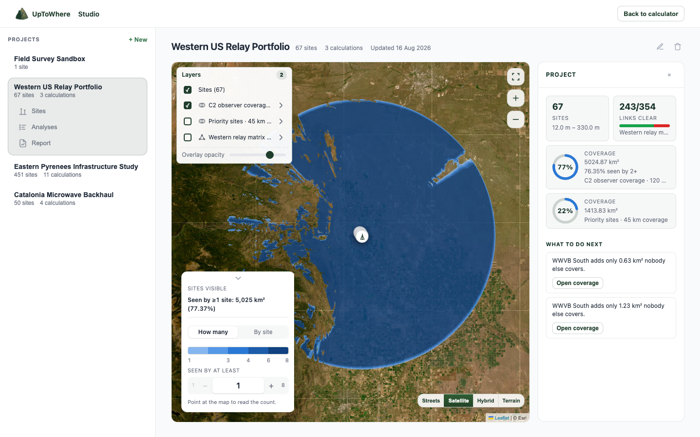
What Studio does for a drone operation
Observer and dock placement
Compute what each pilot, visual observer or dock actually sees at its real mount height, alone or combined into one coverage map.
C2 link screening
Ground station to aircraft at altitude is one calculation, with k = 4/3 radio horizon and Fresnel clearance by frequency.
Terrain shadow, mapped
The parts of the operating area no observer can see show up before anyone drives to the site.
Evidence a reviewer can open
KMZ, GeoTIFF and a PDF whose methodology page states dataset, parameters and engine version.
From positions to evidence
| Step | You do | Studio returns |
|---|---|---|
| Place people | Pilot, observer or dock at the real mount height | A 360° viewshed each, or one combined coverage map, up to 60 observers |
| Screen C2 | Ground station to aircraft at altitude | Radio horizon at k = 4/3 and Fresnel clearance at your C2 frequency, mode stated |
| See the shadow | Look at the operating area | The ground no observer can see, mapped before anyone drives out |
| Hand over | Export | KMZ, GeoTIFF and a PDF whose methodology page states dataset, parameters and engine version |
Studio is 49€/month or 490€/year. No credits. What you export is yours.
What we deliberately do not do
No RF propagation prediction, no airspace or population risk assessment, no regulatory advice. Terrain line of sight is one annex of a safety case, not the case; every output states it is a modelled result on a surface model, so verify marginal geometry with a flight test.
FAQ
Can it model the drone at altitude rather than on the ground?
Yes. Point-to-point checks take a target height above ground at the far end, so ground station to aircraft at any altitude over any terrain is a single calculation. Cumulative coverage runs take a receptor height, which serves as the aircraft height over the whole area.
Is this optical or radio line of sight?
Both, explicitly. Optical mode uses standard optical refraction for what a human observer sees; radio mode uses a k = 4/3 effective earth radius and, with a frequency set, Fresnel clearance for the C2 link geometry. The mode is stated on the result.
What terrain data does it use?
Copernicus GLO-30, a 30 m global surface model with stated sub-4 m vertical accuracy, named on every export. Worldwide coverage, so remote operating areas work the same as anywhere else.
Will a regulator accept it?
What regulators assess is your safety case; what they expect of an annex like this is stated data, stated method and reproducibility, which is exactly what the exports carry. It has no formal approval from any authority, and we make no such claim.
How is it priced?
One price: 49€/month or 490€/year, unmetered. What you export is yours to hand on, and yours to check.
Explore more Studio workflows
Studio is 49€/month, unmetered
Bulk runs, exports and reports, all included.
See what Studio includesAlready have Studio? Open it