 UpToWhere
Path studies with the antenna height already solved
Check every remote site against the master in one run, and get the mast height or relay that fixes the blocked ones.
See what Studio includes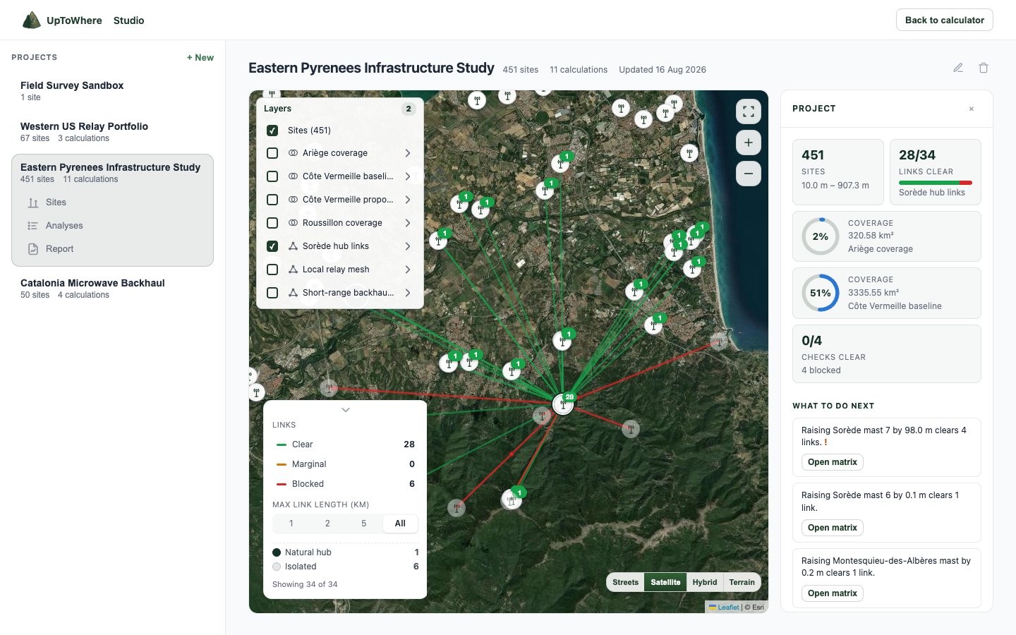
What Studio does for a telemetry network
Every remote, one run
CSV in, hub matrix out: a clear, marginal or blocked verdict for every remote against the master, worst first.
The height solver
Blocked paths return the exact mast raise that clears them, at either end, with the least-total-steel option flagged.
Relay finder
When no mast height is enough, the corridor is searched for a repeater site that provably sees both ends, re-verified leg by leg.
A report the client can file
Site schedule, worst-first link tables, path profiles for the flagged links, methodology attached.
From a network to solved heights
| Step | You do | Studio returns |
|---|---|---|
| Import | Master plus remotes as CSV | Up to 500 sites, metres or feet |
| Matrix | Every remote against the master in one run | Distance, bearing and worst clearance, sorted worst-first, up to 1,500 links |
| Raise | Open a blocked hop | The exact mast raise that clears, either end, least-total-steel flagged |
| Relay | When no height is enough | A repeater site that sees both ends, re-checked leg by leg |
| Hand over | Export | Site schedule, worst-first tables, path profiles and a methodology-stamped PDF |
Studio is 49€/month or 490€/year. No credits. What you export is yours.
What we deliberately do not do
No propagation prediction: no dBm, no fade margins, no availability percentages, no interference coordination. Terrain feasibility with stated physics and solved heights: the part of the path study that terrain decides, and most of the go/no-go. For licensed-band engineering, commission a full path study.
FAQ
How is this different from a free RF line-of-sight calculator?
A horizon calculator takes two antenna heights and returns the distance at which the Earth gets in the way; it knows nothing about the ridge between your sites. Studio walks the actual terrain profile between every pair, tests Fresnel clearance at the frequency you run, and returns the antenna height that clears each blocked path. For one link, the free calculator on our home page does this too; Studio does it for the whole network in one matrix.
Which frequencies does the Fresnel check support?
Any from 30 MHz to 100 GHz, with presets at 900 MHz, 2.4 GHz and 5.8 GHz. Without a frequency the check is bare terrain line of sight, and says so.
How accurate is the terrain?
Copernicus GLO-30, 30 m cells, stated sub-4 m vertical accuracy, named on every export. Height advice adds the accuracy allowance per ITU-R P.530, Fresnel-shaped. Our validation against a field-surveyed path study is published: elevations within 2 m, azimuths within 0.03 degrees.
Can I bring my whole network in at once?
CSV import takes up to 500 sites per file with names, coordinates and heights, metric or imperial. A matrix run covers up to 1,500 links, and refuses over-cap runs with the counts rather than silently truncating.
Does it work offline or on-premise?
No, it is a browser product. Coordinates you enter are processed on our EU servers; results are stored in your account and deletable on demand.
How is it priced?
One price: 49€/month or 490€/year, unmetered. What you export is yours to hand on, and yours to check.
Explore more Studio workflows
Studio is 49€/month, unmetered
Bulk runs, exports and reports, all included.
See what Studio includesAlready have Studio? Open it