UpToWhere
What can you see from Mount Bachelor?
Oregon's largest ski resort sits atop a dormant volcano with the nation's longest ski season.
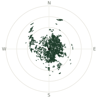
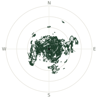
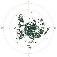
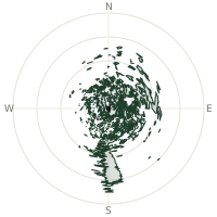
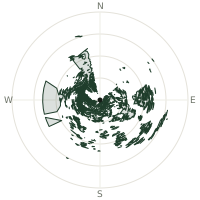
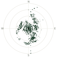
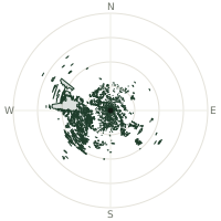
From Mount Bachelor, the terrain-limited line of sight reaches up to 289 km. The single farthest piece of visible terrain lies 289 km to the south (bearing 188°), at 4,191 m elevation. These results account for Earth's curvature and standard atmospheric refraction, computed from 30-meter resolution Copernicus GLO-30 elevation data across 2,314,010 terrain samples.
Open the interactive visibility map →Visibility by direction
The horizon is most open toward the west-northwest, where sightlines run 163 km on average; terrain closes the view down fastest to the north-northwest, at 27.9 km.
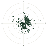
| N | 110 km | |
| NNE | 150 km | |
| NE | 114 km | |
| ENE | 139 km | |
| E | 160 km | |
| ESE | 120 km | |
| SE | 101 km | |
| SSE | 134 km | |
| S | 156 km | |
| SSW | 104 km | |
| SW | 87.0 km | |
| WSW | 123 km | |
| W | 155 km | |
| WNW | 163 km | |
| NW | 130 km | |
| NNW | 27.9 km |
Farthest named landmarks in view
435 named peaks, hills and headlands stand inside this viewshed. These are the farthest ones you could pick out on a clear day:
| Landmark | Visible distance | Direction | Elevation |
|---|---|---|---|
| Misery Hill | 289 km | S · 188° | 4,191 m |
| Shastina | 289 km | S · 189° | 3,740 m |
| Mount Shasta | 288 km | S · 188° | 4,303 m |
| Mount Adams | 248 km | N · 4° | 3,745 m |
| Pikers Peak | 247 km | N · 4° | 3,535 m |
| Rabbit Ears | 242 km | E · 81° | 2,530 m |
About Mount Bachelor
Mount Bachelor, formerly called Bachelor Butte, is a dormant stratovolcano in Oregon's High Cascades that now hosts the largest ski resort by area in the state. Founded in 1958 on a one-year lease by ski trooper Bill Healy, the resort grew into the nation's sixth-largest, with chairlifts reaching the summit and a season stretching from mid-November through the end of May, weather permitting. The mountain itself remains a moderate volcanic hazard, though USGS considers eruption unlikely in the near future.
Did you know?
- The Mount Bachelor Ski Area was founded on 19 December 1958 with $75,000 and a one-year forest service lease.
- Because the mountain is a nearly symmetrical volcanic cone, its summit chairlift is one of the few in the world that lets skiers descend in almost any direction, a full 360 degrees around the peak.
- A chairlift operates year-round (weather permitting), making it the only major Cascade volcano with summer ski access.
- Founder Bill Healy was a veteran of the U.S. Army's 10th Mountain Division, the WWII ski troops who went on to found many of America's postwar ski resorts.
- Mount Bachelor remains a dormant stratovolcano; whether it is extinct or merely inactive remains geologically unclear.
Frequently asked questions
How far can you see from Mount Bachelor?
On a clear day the terrain allows a line of sight of up to 289 km from Mount Bachelor. The average visible distance across all 360 directions is 123 km. Atmospheric conditions (haze, humidity) usually reduce practical visibility below the terrain-limited maximum.
What is the farthest point visible from Mount Bachelor?
The farthest terrain visible from Mount Bachelor lies 289 km to the south, at an elevation of 4,191 m. Earth's curvature and atmospheric refraction are accounted for in this calculation.
How high is Mount Bachelor?
The observation point at Mount Bachelor sits at 2,771 m above sea level (Copernicus GLO-30 elevation model).
How is this visibility map calculated?
UpToWhere traces lines of sight in 360 directions from the observer using 30 m-resolution Copernicus terrain data, correcting for Earth curvature and standard atmospheric refraction. You can run the same analysis for any point on Earth with the free calculator.
Run your own analysis
Want to know what you can see from your house, a summit you're planning to climb, or a plot of land? UpToWhere computes the same 360° viewshed for any point on Earth in seconds — free.
Try the viewshed calculator