UpToWhere
What can you see from Space Needle?
1962 Seattle World's Fair icon: 605 feet reaching toward tomorrow.
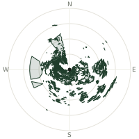
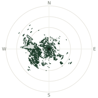
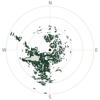
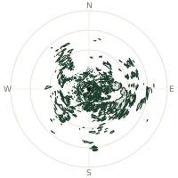
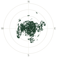
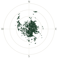
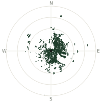
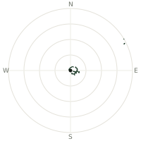
From Space Needle, the terrain-limited line of sight reaches up to 159 km. The single farthest piece of visible terrain lies 159 km to the south (bearing 175°), at 2,244 m elevation. These results account for Earth's curvature and standard atmospheric refraction, computed from 30-meter resolution Copernicus GLO-30 elevation data across 1,902,766 terrain samples.
Open the interactive visibility map →Visibility by direction
The horizon is most open toward the south, where sightlines run 108 km on average; terrain closes the view down fastest to the south-southwest, at 51.3 km.
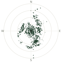
| N | 73.3 km | |
| NNE | 102 km | |
| NE | 76.1 km | |
| ENE | 67.8 km | |
| E | 63.2 km | |
| ESE | 51.6 km | |
| SE | 78.1 km | |
| SSE | 93.0 km | |
| S | 108 km | |
| SSW | 51.3 km | |
| SW | 70.9 km | |
| WSW | 61.1 km | |
| W | 67.4 km | |
| WNW | 61.7 km | |
| NW | 57.3 km | |
| NNW | 51.4 km |
About Space Needle
The Space Needle rose for Seattle's 1962 World's Fair at 605 feet tall, an immediate architectural icon that drew 2.56 million fairgoers to its observation deck at 520 feet. Completed in April 1962, it momentarily held the title of westernmost tall building in North America and remains an enduring symbol of mid-century futurism and Pacific Northwest ambition.
Did you know?
- 605 feet tall—184 meters total height
- In 2018, the tower added the world's first and only revolving glass floor, called The Loupe, letting visitors look straight down through the observation level as it slowly turns.
- Built for 1962 Seattle World's Fair; cost $4.5 million
- The restaurant that once crowned the tower rotated once every 47 minutes, giving diners a full view of the city over the course of a meal.
- Tallest building west of Mississippi at completion 1962
Frequently asked questions
How far can you see from Space Needle?
On a clear day the terrain allows a line of sight of up to 159 km from Space Needle. The average visible distance across all 360 directions is 70.9 km. Atmospheric conditions (haze, humidity) usually reduce practical visibility below the terrain-limited maximum.
What is the farthest point visible from Space Needle?
The farthest terrain visible from Space Needle lies 159 km to the south, at an elevation of 2,244 m. Earth's curvature and atmospheric refraction are accounted for in this calculation.
How high is Space Needle?
The observation point at Space Needle sits at 230 m above sea level (Copernicus GLO-30 elevation model).
How is this visibility map calculated?
UpToWhere traces lines of sight in 360 directions from the observer using 30 m-resolution Copernicus terrain data, correcting for Earth curvature and standard atmospheric refraction. You can run the same analysis for any point on Earth with the free calculator.
Run your own analysis
Want to know what you can see from your house, a summit you're planning to climb, or a plot of land? UpToWhere computes the same 360° viewshed for any point on Earth in seconds — free.
Try the viewshed calculator