UpToWhere
What can you see from Glacier Peak?
Washington's most explosive volcano, yet so isolated in the high ridge it barely shows on any skyline.
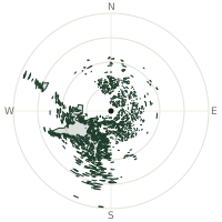
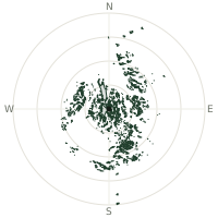
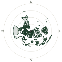
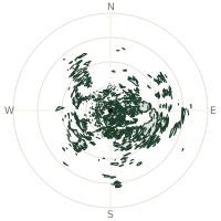
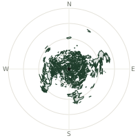
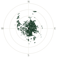
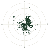
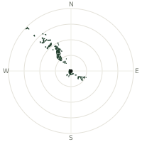
From Glacier Peak, the terrain-limited line of sight reaches up to 361 km. The single farthest piece of visible terrain lies 361 km to the west-northwest (bearing 301°), at 1,798 m elevation. These results account for Earth's curvature and standard atmospheric refraction, computed from 30-meter resolution Copernicus GLO-30 elevation data across 2,365,702 terrain samples.
Open the interactive visibility map →Visibility by direction
The horizon is most open toward the west-northwest, where sightlines run 246 km on average; terrain closes the view down fastest to the east-northeast, at 81.5 km.
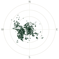
| N | 98.1 km | |
| NNE | 88.6 km | |
| NE | 99.5 km | |
| ENE | 81.5 km | |
| E | 84.3 km | |
| ESE | 116 km | |
| SE | 171 km | |
| SSE | 89.3 km | |
| S | 144 km | |
| SSW | 152 km | |
| SW | 217 km | |
| WSW | 184 km | |
| W | 202 km | |
| WNW | 246 km | |
| NW | 175 km | |
| NNW | 139 km |
Farthest named landmarks in view
811 named peaks, hills and headlands stand inside this viewshed. These are the farthest ones you could pick out on a clear day:
| Landmark | Visible distance | Direction | Elevation |
|---|---|---|---|
| Jutland Mountain | 362 km | WNW · 301° | 1,821 m |
| Milk Shakes | 338 km | SE · 133° | 1,849 m |
| Chase Mountain | 332 km | SE · 131° | 1,721 m |
| Mount Arrowsmith | 285 km | WNW · 297° | 1,819 m |
| Okay Mountain | 259 km | WNW · 299° | 882 m |
| Pelion Mountain | 255 km | NW · 321° | 2,312 m |
About Glacier Peak
Glacier Peak, at 10,541 feet, is one of the five major stratovolcanoes in Washington but the most remote, sitting deep in the Mount Baker-Snoqualmie National Forest seventy miles northeast of Seattle. It is also one of the most active and explosive in the Cascade Range, producing some of the largest eruptions in the past 15,000 years. About 13,100 years ago, Glacier Peak erupted with such violence that it scattered ash across the Pacific Northwest and sent lahars as far as Puget Sound, yet its isolated location keeps it far less famous than its taller neighbours.
Did you know?
- At 10,541 feet, Glacier Peak is the fourth-highest in Washington, yet far less conspicuous than taller peaks.
- No road comes close to its base — reaching Glacier Peak requires a multi-day trek, often along a stretch of the Pacific Crest Trail, making it one of the hardest Cascade volcanoes to simply visit.
- More than a dozen glaciers descend its flanks, giving the peak its name.
- The USGS ranks Glacier Peak among the highest-threat volcanoes in the United States for lahar hazard.
- As of 2024 it is monitored by a single aging seismometer, the least-monitored major volcano in Washington.
Frequently asked questions
How far can you see from Glacier Peak?
On a clear day the terrain allows a line of sight of up to 361 km from Glacier Peak. The average visible distance across all 360 directions is 143 km. Atmospheric conditions (haze, humidity) usually reduce practical visibility below the terrain-limited maximum.
What is the farthest point visible from Glacier Peak?
The farthest terrain visible from Glacier Peak lies 361 km to the west-northwest, at an elevation of 1,798 m. Earth's curvature and atmospheric refraction are accounted for in this calculation.
How high is Glacier Peak?
The observation point at Glacier Peak sits at 3,218 m above sea level (Copernicus GLO-30 elevation model).
How is this visibility map calculated?
UpToWhere traces lines of sight in 360 directions from the observer using 30 m-resolution Copernicus terrain data, correcting for Earth curvature and standard atmospheric refraction. You can run the same analysis for any point on Earth with the free calculator.
Run your own analysis
Want to know what you can see from your house, a summit you're planning to climb, or a plot of land? UpToWhere computes the same 360° viewshed for any point on Earth in seconds — free.
Try the viewshed calculator