UpToWhere
What can you see from Mount Etna?
Ancient Greeks thought its rumbling was a giant trapped alive beneath the rock.
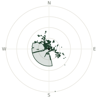
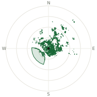
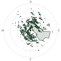
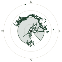
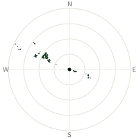
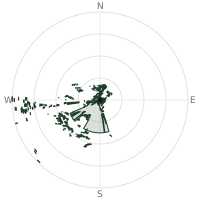
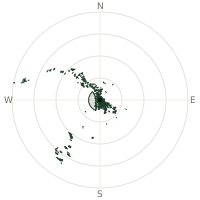
From Mount Etna, the terrain-limited line of sight reaches up to 359 km. The single farthest piece of visible terrain lies 359 km to the north (bearing 356°), at 1,524 m elevation. These results account for Earth's curvature and standard atmospheric refraction, computed from 30-meter resolution Copernicus GLO-30 elevation data across 2,378,726 terrain samples.
Open the interactive visibility map →Visibility by direction
The horizon is most open toward the north, where sightlines run 302 km on average; terrain closes the view down fastest to the west, at 125 km.
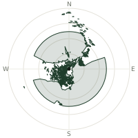
| N | 302 km | |
| NNE | 246 km | |
| NE | 185 km | |
| ENE | 152 km | |
| E | 221 km | |
| ESE | 221 km | |
| SE | 221 km | |
| SSE | 221 km | |
| S | 221 km | |
| SSW | 216 km | |
| SW | 221 km | |
| WSW | 213 km | |
| W | 125 km | |
| WNW | 199 km | |
| NW | 220 km | |
| NNW | 221 km |
Farthest named landmarks in view
179 named peaks, hills and headlands stand inside this viewshed. These are the farthest ones you could pick out on a clear day:
| Landmark | Visible distance | Direction | Elevation |
|---|---|---|---|
| Monte Accellica | 336 km | N · 0° | 1,660 m |
| Raione | 335 km | N · 0° | 1,606 m |
| Monte Monna | 331 km | N · 358° | 1,195 m |
| Monte Telegrafo | 331 km | N · 360° | 1,178 m |
| Monte Circhio | 330 km | N · 360° | 1,073 m |
| Monte Stella | 330 km | N · 357° | 953 m |
About Mount Etna
Mount Etna is Europe's tallest and most active volcano, rising on Sicily's east coast with an eruptive history that stretches back roughly 500,000 years and at least 2,700 years of it documented by observers. Ancient Greeks placed Hephaestus's forge and the one-eyed Cyclopes inside the mountain, and blamed its tremors on the giant Typhon, pinned underneath by Zeus. Sicilians still call it Mongibello, and Etna became a UNESCO World Heritage Site in 2013, its summit height remeasured every few years since eruptions keep building up and collapsing its cone.
Did you know?
- On especially active nights, the glow from Etna's eruptions has been seen from Malta, more than 160 kilometres away across the sea.
- Sicilians call it Mongibello, a name blending the Latin 'mons' with the Arabic 'gebel,' both meaning mountain.
- Legend holds that the philosopher Empedocles leapt into Etna's crater to prove he was immortal — and that the volcano exposed the ruse by spitting back one of his bronze sandals.
- Vineyards planted directly in Etna's mineral-rich volcanic soil produce some of Sicily's most sought-after wines.
- On clear days, the Aeolian Islands and mainland Calabria are visible from Etna's upper slopes across the Strait of Messina.
Frequently asked questions
How far can you see from Mount Etna?
On a clear day the terrain allows a line of sight of up to 359 km from Mount Etna. The average visible distance across all 360 directions is 213 km. Atmospheric conditions (haze, humidity) usually reduce practical visibility below the terrain-limited maximum.
What is the farthest point visible from Mount Etna?
The farthest terrain visible from Mount Etna lies 359 km to the north, at an elevation of 1,524 m. Earth's curvature and atmospheric refraction are accounted for in this calculation.
How high is Mount Etna?
The observation point at Mount Etna sits at 3,334 m above sea level (Copernicus GLO-30 elevation model).
How is this visibility map calculated?
UpToWhere traces lines of sight in 360 directions from the observer using 30 m-resolution Copernicus terrain data, correcting for Earth curvature and standard atmospheric refraction. You can run the same analysis for any point on Earth with the free calculator.
Run your own analysis
Want to know what you can see from your house, a summit you're planning to climb, or a plot of land? UpToWhere computes the same 360° viewshed for any point on Earth in seconds — free.
Try the viewshed calculator