UpToWhere
What can you see from Ponte Vecchio?
Renaissance merchant bridge: the only Arno crossing spared by war.
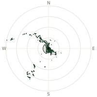
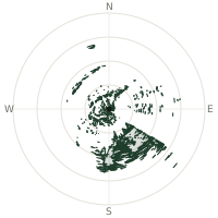
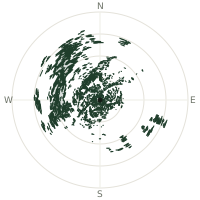
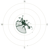
From Ponte Vecchio, the terrain-limited line of sight reaches up to 90.0 km. The single farthest piece of visible terrain lies 90.0 km to the west-northwest (bearing 295°), at 1,890 m elevation. These results account for Earth's curvature and standard atmospheric refraction, computed from 30-meter resolution Copernicus GLO-30 elevation data across 1,854,784 terrain samples.
Open the interactive visibility map →Visibility by direction
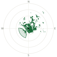
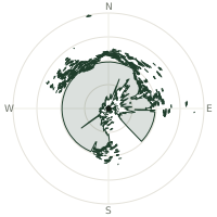
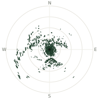
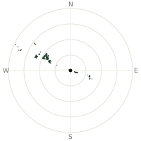
The horizon is most open toward the west-northwest, where sightlines run 37.4 km on average; terrain closes the view down fastest to the south-southwest, at 0.1 km.
| N | 0.1 km | |
| NNE | 0.1 km | |
| NE | 0.1 km | |
| ENE | 0.1 km | |
| E | 0.1 km | |
| ESE | 10.1 km | |
| SE | 1.0 km | |
| SSE | 0.1 km | |
| S | 0.1 km | |
| SSW | 0.1 km | |
| SW | 0.1 km | |
| WSW | 0.1 km | |
| W | 0.2 km | |
| WNW | 37.4 km | |
| NW | 4.0 km | |
| NNW | 0.1 km |
Farthest named landmarks in view
4 named peaks, hills and headlands stand inside this viewshed. These are the farthest ones you could pick out on a clear day:
| Landmark | Visible distance | Direction | Elevation |
|---|---|---|---|
| Monte Tambura | 90.2 km | WNW · 295° | 1,890 m |
| Pania Secca | 79.0 km | WNW · 293° | 1,711 m |
| Monte Rondinaio | 65.5 km | NW · 306° | 1,964 m |
| Monte Pilli | 9.5 km | ESE · 110° | 487 m |
About Ponte Vecchio
Ponte Vecchio, rebuilt 1345 by Taddeo Gaddi, spans the Arno with innovative three-arch segmental design. Jewelers, goldsmiths, and silversmiths occupy the shops since 1593 when Grand Duke Ferdinand I decreed their exclusive occupancy. As the sole Florence bridge surviving WWII destruction, it endures as Renaissance Florence's most iconic span.
Did you know?
- The elevated Vasari Corridor, built in 1565, runs above the bridge's shops, letting the Medici family walk between their palaces without ever mixing with the public below.
- Before goldsmiths arrived in 1593, the bridge was lined with butchers and tanners, whose waste and stench became so offensive that the Grand Duke evicted them in favour of jewelers.
- Adolf Hitler reportedly ordered Ponte Vecchio spared during the 1944 German retreat, admiring it from an earlier visit — troops instead demolished the buildings at both ends to block access, which is why the streets around the bridge look newer than the bridge itself.
- Shop owners on the bridge today must follow strict preservation rules requiring historic wooden shutters and facades, keeping the centuries-old appearance intact.
- Bridge first documented 996; destroyed and rebuilt multiple times.
Frequently asked questions
How far can you see from Ponte Vecchio?
On a clear day the terrain allows a line of sight of up to 90.0 km from Ponte Vecchio. The average visible distance across all 360 directions is 3.3 km. Atmospheric conditions (haze, humidity) usually reduce practical visibility below the terrain-limited maximum.
What is the farthest point visible from Ponte Vecchio?
The farthest terrain visible from Ponte Vecchio lies 90.0 km to the west-northwest, at an elevation of 1,890 m. Earth's curvature and atmospheric refraction are accounted for in this calculation.
How high is Ponte Vecchio?
The observation point at Ponte Vecchio sits at 50 m above sea level (Copernicus GLO-30 elevation model).
How is this visibility map calculated?
UpToWhere traces lines of sight in 360 directions from the observer using 30 m-resolution Copernicus terrain data, correcting for Earth curvature and standard atmospheric refraction. You can run the same analysis for any point on Earth with the free calculator.
Run your own analysis
Want to know what you can see from your house, a summit you're planning to climb, or a plot of land? UpToWhere computes the same 360° viewshed for any point on Earth in seconds — free.
Try the viewshed calculator