UpToWhere
What can you see from Mont Blanc?
It birthed modern mountaineering, and its icy summit still shifts height each year.
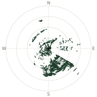
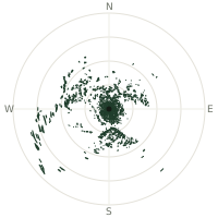
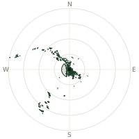
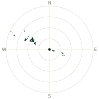
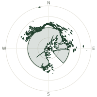
From Mont Blanc, the terrain-limited line of sight reaches up to 325 km. The single farthest piece of visible terrain lies 325 km to the southwest (bearing 234°), at 1,411 m elevation. These results account for Earth's curvature and standard atmospheric refraction, computed from 30-meter resolution Copernicus GLO-30 elevation data across 2,530,157 terrain samples.
Open the interactive visibility map →Visibility by direction
The horizon is most open toward the north-northwest, where sightlines run 259 km on average; terrain closes the view down fastest to the east-northeast, at 100 km.
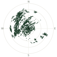
| N | 226 km | |
| NNE | 205 km | |
| NE | 127 km | |
| ENE | 100 km | |
| E | 118 km | |
| ESE | 196 km | |
| SE | 110 km | |
| SSE | 169 km | |
| S | 147 km | |
| SSW | 115 km | |
| SW | 154 km | |
| WSW | 238 km | |
| W | 234 km | |
| WNW | 227 km | |
| NW | 243 km | |
| NNW | 259 km |
Farthest named landmarks in view
1,783 named peaks, hills and headlands stand inside this viewshed. These are the farthest ones you could pick out on a clear day:
| Landmark | Visible distance | Direction | Elevation |
|---|---|---|---|
| Mont Aigoual | 321 km | SW · 235° | 1,565 m |
| Le Portalet | 321 km | SW · 235° | 1,565 m |
| Le Montadou | 321 km | SW · 236° | 1,463 m |
| Mont Mouchet | 289 km | WSW · 252° | 1,497 m |
| Mont Lozere - Pic Cassini | 286 km | WSW · 237° | 1,680 m |
| La Tête de Boeuf | 285 km | WSW · 237° | 1,587 m |
About Mont Blanc
Mont Blanc is the highest peak in the Alps and in Western Europe, its summit capped in permanent ice and snow rather than bare rock, which is why official measurements of its height shift slightly most years. Jacques Balmat and Michel-Gabriel Paccard reached the top on 8 August 1786, a climb many historians treat as the birth of modern mountaineering. The mountain straddles the France-Italy border above the resort town of Chamonix, reached today by the Aiguille du Midi cable car and by a road tunnel bored straight through the massif below.
Did you know?
- The Compagnie des Guides de Chamonix, founded in 1821 in the wake of Balmat and Paccard's climb, is the world's oldest mountain guide company still in operation.
- Marie Paradis became the first woman to reach the summit in 1808, though legend says her guides had to drag her the final stretch.
- The Mont Blanc Tunnel, opened in 1965, runs 11.6 kilometres beneath the massif, linking France and Italy.
- On clear days, climbers on the summit ridge can pick out the Matterhorn and the peaks of the Bernese Alps far to the east.
- The Mer de Glace, France's largest glacier, flows off Mont Blanc's slopes and has been retreating rapidly for decades.
Frequently asked questions
How far can you see from Mont Blanc?
On a clear day the terrain allows a line of sight of up to 325 km from Mont Blanc. The average visible distance across all 360 directions is 179 km. Atmospheric conditions (haze, humidity) usually reduce practical visibility below the terrain-limited maximum.
What is the farthest point visible from Mont Blanc?
The farthest terrain visible from Mont Blanc lies 325 km to the southwest, at an elevation of 1,411 m. Earth's curvature and atmospheric refraction are accounted for in this calculation.
How high is Mont Blanc?
The observation point at Mont Blanc sits at 4,821 m above sea level (Copernicus GLO-30 elevation model).
How is this visibility map calculated?
UpToWhere traces lines of sight in 360 directions from the observer using 30 m-resolution Copernicus terrain data, correcting for Earth curvature and standard atmospheric refraction. You can run the same analysis for any point on Earth with the free calculator.
Run your own analysis
Want to know what you can see from your house, a summit you're planning to climb, or a plot of land? UpToWhere computes the same 360° viewshed for any point on Earth in seconds — free.
Try the viewshed calculator