UpToWhere
What can you see from St. Peter's Basilica (dome)?
Michelangelo designed the dome at 71 and never lived to see it capped.
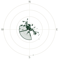
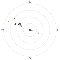
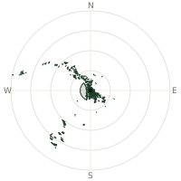
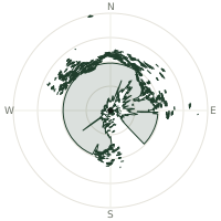
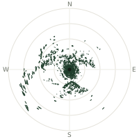
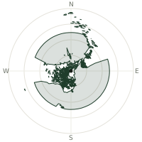
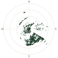
From St. Peter's Basilica (dome), the terrain-limited line of sight reaches up to 127 km. The single farthest piece of visible terrain lies 127 km to the east-southeast (bearing 103°), at 2,030 m elevation. These results account for Earth's curvature and standard atmospheric refraction, computed from 30-meter resolution Copernicus GLO-30 elevation data across 1,888,662 terrain samples.
Open the interactive visibility map →Visibility by direction
The horizon is most open toward the northeast, where sightlines run 68.9 km on average; terrain closes the view down fastest to the south, at 21.7 km.
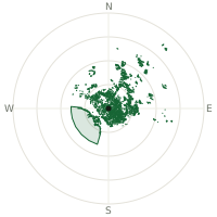
| N | 34.6 km | |
| NNE | 65.1 km | |
| NE | 68.9 km | |
| ENE | 54.9 km | |
| E | 54.6 km | |
| ESE | 37.6 km | |
| SE | 28.1 km | |
| SSE | 24.2 km | |
| S | 21.7 km | |
| SSW | 41.4 km | |
| SW | 50.5 km | |
| WSW | 50.5 km | |
| W | 39.5 km | |
| WNW | 35.4 km | |
| NW | 41.5 km | |
| NNW | 43.1 km |
About St. Peter's Basilica (dome)
St. Peter's Basilica took 120 years to build, from 1506 to 1626, passing through the hands of Bramante, Michelangelo, and Carlo Maderno before Bernini added the piazza's colonnade. Michelangelo took over the dome late in life, drawing on what he'd learned studying Brunelleschi's dome in Florence, but died in 1564 with it unfinished; Giacomo della Porta completed it in 1590. It remains the largest church in the world by interior floor area.
Did you know?
- Michelangelo was 71 when he took charge of the dome and died 26 years before its completion in 1590, never seeing it finished.
- The final stretch of the climb to the top runs through a narrow stairwell that tilts inward, following the dome's own curve.
- At roughly 136 metres, the dome ended up taller than the one in Florence that Michelangelo studied before designing it.
- St. Peter's tomb is believed to lie in an ancient necropolis directly beneath the basilica's high altar.
- From the dome's lantern, Bernini's colonnaded square, the Vatican Gardens, and the rooftops of Rome spread out in every direction.
Frequently asked questions
How far can you see from St. Peter's Basilica (dome)?
On a clear day the terrain allows a line of sight of up to 127 km from St. Peter's Basilica (dome). The average visible distance across all 360 directions is 43.2 km. Atmospheric conditions (haze, humidity) usually reduce practical visibility below the terrain-limited maximum.
What is the farthest point visible from St. Peter's Basilica (dome)?
The farthest terrain visible from St. Peter's Basilica (dome) lies 127 km to the east-southeast, at an elevation of 2,030 m. Earth's curvature and atmospheric refraction are accounted for in this calculation.
How high is St. Peter's Basilica (dome)?
The observation point at St. Peter's Basilica (dome) sits at 174 m above sea level (Copernicus GLO-30 elevation model).
How is this visibility map calculated?
UpToWhere traces lines of sight in 360 directions from the observer using 30 m-resolution Copernicus terrain data, correcting for Earth curvature and standard atmospheric refraction. You can run the same analysis for any point on Earth with the free calculator.
Run your own analysis
Want to know what you can see from your house, a summit you're planning to climb, or a plot of land? UpToWhere computes the same 360° viewshed for any point on Earth in seconds — free.
Try the viewshed calculator