UpToWhere
What can you see from Victoria Falls?
Africa's smoke: Mosi-oa-Tunya thunders across Zambezi gorge.
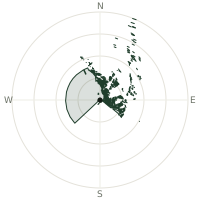
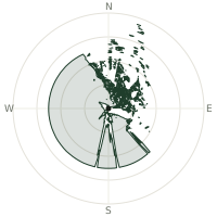
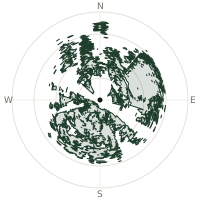
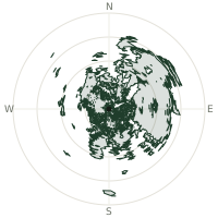
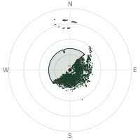
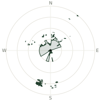
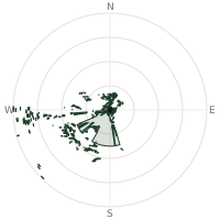
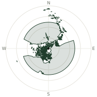
From Victoria Falls, the terrain-limited line of sight reaches up to 2.5 km. The single farthest piece of visible terrain lies 2.5 km to the east (bearing 83°), at 937 m elevation. These results account for Earth's curvature and standard atmospheric refraction, computed from 30-meter resolution Copernicus GLO-30 elevation data across 2,037,864 terrain samples.
Open the interactive visibility map →Visibility by direction
The horizon is most open toward the west-northwest, where sightlines run 0.7 km on average; terrain closes the view down fastest to the east-southeast, at 0.0 km.
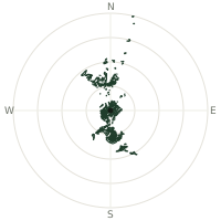
| N | 0.1 km | |
| NNE | 0.1 km | |
| NE | 0.1 km | |
| ENE | 0.2 km | |
| E | 0.5 km | |
| ESE | 0.0 km | |
| SE | 0.0 km | |
| SSE | 0.0 km | |
| S | 0.0 km | |
| SSW | 0.0 km | |
| SW | 0.0 km | |
| WSW | 0.0 km | |
| W | 0.2 km | |
| WNW | 0.7 km | |
| NW | 0.2 km | |
| NNW | 0.1 km |
About Victoria Falls
Victoria Falls, known locally as Mosi-oa-Tunya (The Smoke That Thunders), spans 1,708 meters and drops 108 meters along the Zambia-Zimbabwe border. At the rainy season peak, 500 million cubic meters of water cascade over the edge each minute. David Livingstone named them in 1855 after Queen Victoria.
Did you know?
- Width 1,708 meters (5,604 feet); height 108 meters (354 feet).
- Largest waterfall by volume of falling water globally.
- During peak flow, spray from the falls rises more than 400 metres into the air, visible from up to 50 kilometres away.
- During the low-water season from September to December, swimmers can sit in the Devil's Pool, a natural rock pool right at the lip of the falls.
- UNESCO World Heritage Site designated 1989 by Zambia and Zimbabwe.
Frequently asked questions
How far can you see from Victoria Falls?
On a clear day the terrain allows a line of sight of up to 2.5 km from Victoria Falls. The average visible distance across all 360 directions is 0.1 km. Atmospheric conditions (haze, humidity) usually reduce practical visibility below the terrain-limited maximum.
What is the farthest point visible from Victoria Falls?
The farthest terrain visible from Victoria Falls lies 2.5 km to the east, at an elevation of 937 m. Earth's curvature and atmospheric refraction are accounted for in this calculation.
How high is Victoria Falls?
The observation point at Victoria Falls sits at 869 m above sea level (Copernicus GLO-30 elevation model).
How is this visibility map calculated?
UpToWhere traces lines of sight in 360 directions from the observer using 30 m-resolution Copernicus terrain data, correcting for Earth curvature and standard atmospheric refraction. You can run the same analysis for any point on Earth with the free calculator.
Run your own analysis
Want to know what you can see from your house, a summit you're planning to climb, or a plot of land? UpToWhere computes the same 360° viewshed for any point on Earth in seconds — free.
Try the viewshed calculator