UpToWhere
What can you see from Torre Colpatria (Bogotá)?
Standing in the heart of Bogotá at 2,640 metres elevation, it reaches higher above surrounding terrain than most peaks.
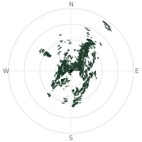
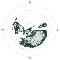
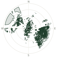
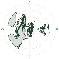
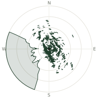
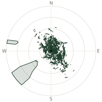
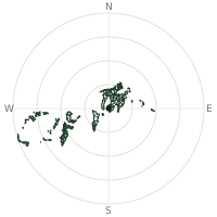
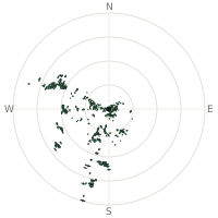
From Torre Colpatria (Bogotá), the terrain-limited line of sight reaches up to 150 km. The single farthest piece of visible terrain lies 150 km to the west-northwest (bearing 293°), at 3,614 m elevation. These results account for Earth's curvature and standard atmospheric refraction, computed from 30-meter resolution Copernicus GLO-30 elevation data across 2,314,252 terrain samples.
Open the interactive visibility map →Visibility by direction
The horizon is most open toward the west, where sightlines run 100 km on average; terrain closes the view down fastest to the east, at 1.9 km.
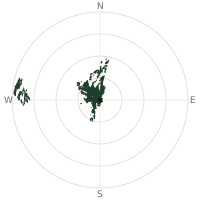
| N | 55.4 km | |
| NNE | 21.4 km | |
| NE | 3.4 km | |
| ENE | 2.7 km | |
| E | 1.9 km | |
| ESE | 2.6 km | |
| SE | 3.7 km | |
| SSE | 4.4 km | |
| S | 8.5 km | |
| SSW | 28.1 km | |
| SW | 17.3 km | |
| WSW | 20.8 km | |
| W | 100 km | |
| WNW | 65.0 km | |
| NW | 41.5 km | |
| NNW | 40.8 km |
About Torre Colpatria (Bogotá)
Torre Colpatria, a 196-metre, 50-storey skyscraper, opened in Bogotá, Colombia in 1979 after construction from 1973 to 1978. The tower sits at an elevation of 2,600 metres above sea level in the Andean high plateau, making it one of the highest observation decks by absolute elevation on the planet. The tower's observation deck provides panoramic views across Bogotá and the surrounding valleys and highlands of the Cundinamarca region, with the Andes mountains dominating the landscape in all directions.
Did you know?
- Torre Colpatria was Colombia's tallest building for decades, only losing the title to BD Bacatá in 2016.
- Located in downtown Bogotá at 2,600 metres elevation, it is one of the world's highest-elevation observation decks.
- It is the second-tallest building in Colombia and a prominent feature of Bogotá's skyline.
- The surrounding landscape features the Andes mountains and the valleys of Cundinamarca region.
- Since 2003, the tower's facade has been wrapped in hundreds of thousands of lights each December, transforming it into a giant illuminated Christmas tree that has become a beloved Bogotá tradition.
Frequently asked questions
How far can you see from Torre Colpatria (Bogotá)?
On a clear day the terrain allows a line of sight of up to 150 km from Torre Colpatria (Bogotá). The average visible distance across all 360 directions is 26.2 km. Atmospheric conditions (haze, humidity) usually reduce practical visibility below the terrain-limited maximum.
What is the farthest point visible from Torre Colpatria (Bogotá)?
The farthest terrain visible from Torre Colpatria (Bogotá) lies 150 km to the west-northwest, at an elevation of 3,614 m. Earth's curvature and atmospheric refraction are accounted for in this calculation.
How high is Torre Colpatria (Bogotá)?
The observation point at Torre Colpatria (Bogotá) sits at 2,772 m above sea level (Copernicus GLO-30 elevation model).
How is this visibility map calculated?
UpToWhere traces lines of sight in 360 directions from the observer using 30 m-resolution Copernicus terrain data, correcting for Earth curvature and standard atmospheric refraction. You can run the same analysis for any point on Earth with the free calculator.
Run your own analysis
Want to know what you can see from your house, a summit you're planning to climb, or a plot of land? UpToWhere computes the same 360° viewshed for any point on Earth in seconds — free.
Try the viewshed calculator