UpToWhere
What can you see from Chimborazo?
The farthest point on Earth from the planet's centre, though not the tallest peak.
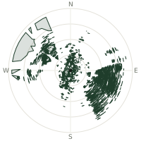
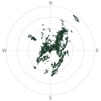
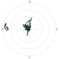
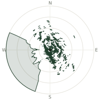
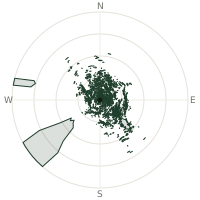
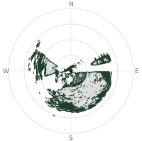
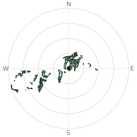
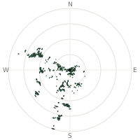
From Chimborazo, the terrain-limited line of sight reaches up to 356 km. The single farthest piece of visible terrain lies 356 km to the southwest (bearing 215°), at 1,127 m elevation. These results account for Earth's curvature and standard atmospheric refraction, computed from 30-meter resolution Copernicus GLO-30 elevation data across 2,658,824 terrain samples.
Open the interactive visibility map →Visibility by direction
The horizon is most open toward the southwest, where sightlines run 313 km on average; terrain closes the view down fastest to the south-southeast, at 95.3 km.
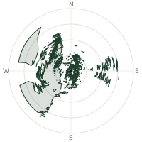
| N | 138 km | |
| NNE | 174 km | |
| NE | 136 km | |
| ENE | 153 km | |
| E | 266 km | |
| ESE | 178 km | |
| SE | 99.6 km | |
| SSE | 95.3 km | |
| S | 135 km | |
| SSW | 189 km | |
| SW | 313 km | |
| WSW | 298 km | |
| W | 266 km | |
| WNW | 303 km | |
| NW | 295 km | |
| NNW | 236 km |
Farthest named landmarks in view
221 named peaks, hills and headlands stand inside this viewshed. These are the farthest ones you could pick out on a clear day:
| Landmark | Visible distance | Direction | Elevation |
|---|---|---|---|
| Cerro Las Varas | 355 km | SSW · 214° | 1,004 m |
| Cerro Conchas | 354 km | SW · 214° | 1,283 m |
| Cerro Tigre | 353 km | SW · 214° | 991 m |
| Cerro La Leche | 353 km | SW · 214° | 1,237 m |
| Cerro Huayabal | 352 km | SSW · 214° | 1,204 m |
| Cerro Los López | 352 km | SW · 214° | 931 m |
About Chimborazo
Chimborazo rises to 6,310 metres in Ecuador and is that country's highest peak. Its summit is roughly 2 kilometres farther from Earth's centre than Mount Everest due to Earth's equatorial bulge. Edward Whymper reached the top twice in 1880, becoming the first documented summiter, and Alexander von Humboldt had ascended to 5,878 metres in 1802, a remarkable achievement for its time.
Did you know?
- Local Indigenous communities revere the mountain as Taita Chimborazo, 'Father Chimborazo,' a powerful protective spirit in Andean tradition.
- Humboldt's sketch of Chimborazo's vegetation zones, from tropical base to icy summit, became one of the founding images of biogeography and inspired generations of naturalists, including Darwin.
- Edward Whymper first ascended in 1880, climbing it twice that year.
- Andean legend casts Chimborazo as the husband of the volcano Tungurahua, with the peak Cotopaxi sometimes cast as their rival or son in regional folklore.
- The Whymper summit peak reaches 6,263 metres, one of four named summits on the massif.
Frequently asked questions
How far can you see from Chimborazo?
On a clear day the terrain allows a line of sight of up to 356 km from Chimborazo. The average visible distance across all 360 directions is 205 km. Atmospheric conditions (haze, humidity) usually reduce practical visibility below the terrain-limited maximum.
What is the farthest point visible from Chimborazo?
The farthest terrain visible from Chimborazo lies 356 km to the southwest, at an elevation of 1,127 m. Earth's curvature and atmospheric refraction are accounted for in this calculation.
How high is Chimborazo?
The observation point at Chimborazo sits at 6,273 m above sea level (Copernicus GLO-30 elevation model).
How is this visibility map calculated?
UpToWhere traces lines of sight in 360 directions from the observer using 30 m-resolution Copernicus terrain data, correcting for Earth curvature and standard atmospheric refraction. You can run the same analysis for any point on Earth with the free calculator.
Run your own analysis
Want to know what you can see from your house, a summit you're planning to climb, or a plot of land? UpToWhere computes the same 360° viewshed for any point on Earth in seconds — free.
Try the viewshed calculator