UpToWhere
What can you see from Machu Picchu?
The Inca's lost city crowns a mist-shrouded Andean ridge.
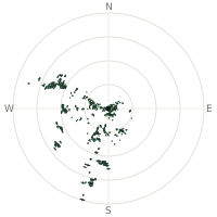
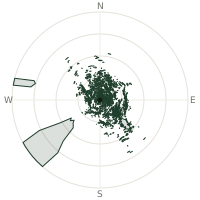
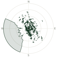
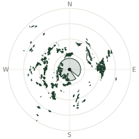
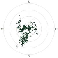
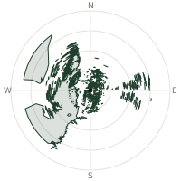
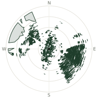
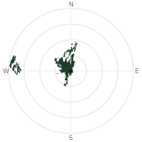
From Machu Picchu, the terrain-limited line of sight reaches up to 31.4 km. The single farthest piece of visible terrain lies 31.4 km to the west-southwest (bearing 250°), at 5,815 m elevation. These results account for Earth's curvature and standard atmospheric refraction, computed from 30-meter resolution Copernicus GLO-30 elevation data across 2,276,509 terrain samples.
Open the interactive visibility map →Visibility by direction
The horizon is most open toward the west-southwest, where sightlines run 24.3 km on average; terrain closes the view down fastest to the south, at 0.5 km.
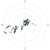
| N | 6.3 km | |
| NNE | 8.2 km | |
| NE | 7.5 km | |
| ENE | 6.8 km | |
| E | 7.4 km | |
| ESE | 2.4 km | |
| SE | 1.3 km | |
| SSE | 1.2 km | |
| S | 0.5 km | |
| SSW | 4.3 km | |
| SW | 10.6 km | |
| WSW | 24.3 km | |
| W | 10.1 km | |
| WNW | 2.4 km | |
| NW | 2.9 km | |
| NNW | 5.3 km |
About Machu Picchu
Machu Picchu perches at 2,430 meters in the Peruvian Andes, an Inca citadel built around 1450. Abandoned during the Spanish conquest, it remained unknown to the outside world until 1911. Today it stands as one of the New Seven Wonders of the World.
Did you know?
- Built circa 1450, likely served as Inca emperor Pachacuti's personal estate.
- Elevation 2,430 meters (7,970 feet) above sea level; remote mountain ridge location.
- Abandoned roughly 100 years later during Spanish conquest period.
- Brought to international attention in 1911 by historian Hiram Bingham III.
Frequently asked questions
How far can you see from Machu Picchu?
On a clear day the terrain allows a line of sight of up to 31.4 km from Machu Picchu. The average visible distance across all 360 directions is 6.3 km. Atmospheric conditions (haze, humidity) usually reduce practical visibility below the terrain-limited maximum.
What is the farthest point visible from Machu Picchu?
The farthest terrain visible from Machu Picchu lies 31.4 km to the west-southwest, at an elevation of 5,815 m. Earth's curvature and atmospheric refraction are accounted for in this calculation.
How high is Machu Picchu?
The observation point at Machu Picchu sits at 2,465 m above sea level (Copernicus GLO-30 elevation model).
How is this visibility map calculated?
UpToWhere traces lines of sight in 360 directions from the observer using 30 m-resolution Copernicus terrain data, correcting for Earth curvature and standard atmospheric refraction. You can run the same analysis for any point on Earth with the free calculator.
Run your own analysis
Want to know what you can see from your house, a summit you're planning to climb, or a plot of land? UpToWhere computes the same 360° viewshed for any point on Earth in seconds — free.
Try the viewshed calculator