UpToWhere
What can you see from Pik Dankova?
The longest known line of sight on Earth begins on this summit.
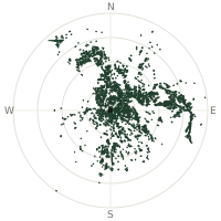
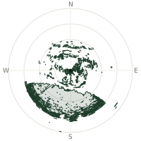
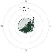
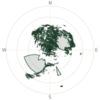
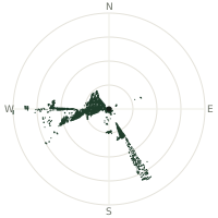
From Pik Dankova, the terrain-limited line of sight reaches up to 508 km. The single farthest piece of visible terrain lies 508 km to the south (bearing 188°), at 5,941 m elevation. These results account for Earth's curvature and standard atmospheric refraction, computed from 30-meter resolution Copernicus GLO-30 elevation data across 2,627,236 terrain samples.
Open the interactive visibility map →Visibility by direction
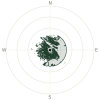
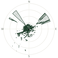
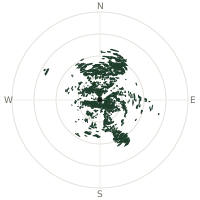
The horizon is most open toward the south, where sightlines run 472 km on average; terrain closes the view down fastest to the east, at 86.5 km.
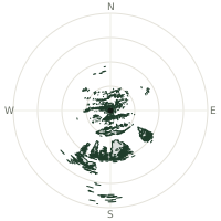
| N | 154 km | |
| NNE | 117 km | |
| NE | 147 km | |
| ENE | 170 km | |
| E | 86.5 km | |
| ESE | 121 km | |
| SE | 203 km | |
| SSE | 229 km | |
| S | 472 km | |
| SSW | 363 km | |
| SW | 206 km | |
| WSW | 143 km | |
| W | 122 km | |
| WNW | 134 km | |
| NW | 146 km | |
| NNW | 157 km |
Farthest named landmarks in view
30 named peaks, hills and headlands stand inside this viewshed. These are the farthest ones you could pick out on a clear day:
| Landmark | Visible distance | Direction | Elevation |
|---|---|---|---|
| Kare Tashi | 445 km | S 180° | 2,927 m |
| Muztagh Ata | 380 km | SW 216° | 7,546 m |
| Kongur Tiube | 345 km | SW 219° | 7,530 m |
| Kongur Shan | 341 km | SW 217° | 7,649 m |
| Qorghan Tagh | 308 km | SW 215° | 2,498 m |
| Baishi Tiereke | 300 km | SSW 211° | 2,685 m |
About Pik Dankova
Pik Dankova is a remote 5,982-metre summit of the Kakshaal-Too, the wall of the Tian Shan that carries the Kyrgyzstan–China border high above the Tarim Basin. It sees almost no ascents, the range is hard to reach from either side, yet it holds a remarkable distinction: UpToWhere's terrain analysis identifies a 536 km line of sight from this summit, running south across the entire Tarim desert to a ridge on the India–China border, the longest known line of sight on Earth.
Did you know?
- The 536 km record line is a genuine cliff-hanger: at standard refraction it is blocked by just 8.4 metres, a 1,210 m desert ridge in the Tarim Basin, 272 km out, is the culprit, while the stronger refraction of a cold, stable dawn lifts it clear by about 40 metres. See the full point-to-point analysis.
- The 508 km sightline on this page answers a stricter question: the farthest terrain visible at standard refraction, with no help from unusual weather. That line runs at bearing 188° to a 5,939 m Kunlun summit, also across the whole width of the Tarim Basin.
- No sightline over 500 km has ever been photographed. The verified world record photograph stands at 493 km (Turkey to Georgia, December 2024): which makes this summit the standing candidate for the next one.
- The 'sea' this summit overlooks is sand: the Tarim Basin holds the Taklamakan, one of the largest shifting-sand deserts on Earth, and its dry, high-altitude air is precisely what makes half-thousand-kilometre sightlines plausible here.
Frequently asked questions
How far can you see from Pik Dankova?
On a clear day the terrain allows a line of sight of up to 508 km from Pik Dankova. The average visible distance across all 360 directions is 186 km. Atmospheric conditions (haze, humidity) usually reduce practical visibility below the terrain-limited maximum.
What is the farthest point visible from Pik Dankova?
The farthest terrain visible from Pik Dankova lies 508 km to the south, at an elevation of 5,941 m. Earth's curvature and atmospheric refraction are accounted for in this calculation.
How high is Pik Dankova?
The observation point at Pik Dankova sits at 5,905 m above sea level (Copernicus GLO-30 elevation model).
How is this visibility map calculated?
UpToWhere traces lines of sight in 360 directions from the observer using 30 m-resolution Copernicus terrain data, correcting for Earth curvature and standard atmospheric refraction. You can run the same analysis for any point on Earth with the free calculator.
Run your own analysis
Want to know what you can see from your house, a summit you're planning to climb, or a plot of land? UpToWhere computes the same 360° viewshed for any point on Earth in seconds, free.
Try the viewshed calculator