UpToWhere
What can you see from Everest?
The world's highest peak commands the Himalayan horizon.
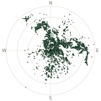
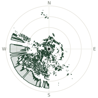
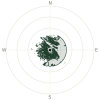
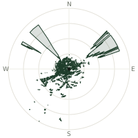
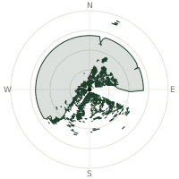
From Everest, the terrain-limited line of sight reaches up to 454 km. The single farthest piece of visible terrain lies 454 km to the south (bearing 190°), at 1,201 m elevation. These results account for Earth's curvature and standard atmospheric refraction, computed from 30-meter resolution Copernicus GLO-30 elevation data across 2,849,091 terrain samples.
Open the interactive visibility map →Visibility by direction
The horizon is most open toward the south, where sightlines run 372 km on average; terrain closes the view down fastest to the east-southeast, at 117 km.
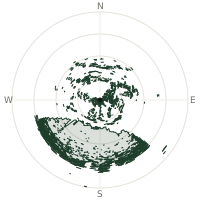
| N | 207 km | |
| NNE | 204 km | |
| NE | 221 km | |
| ENE | 200 km | |
| E | 200 km | |
| ESE | 117 km | |
| SE | 290 km | |
| SSE | 354 km | |
| S | 372 km | |
| SSW | 371 km | |
| SW | 345 km | |
| WSW | 324 km | |
| W | 186 km | |
| WNW | 178 km | |
| NW | 236 km | |
| NNW | 215 km |
Farthest named landmarks in view
225 named peaks, hills and headlands stand inside this viewshed. These are the farthest ones you could pick out on a clear day:
| Landmark | Visible distance | Direction | Elevation |
|---|---|---|---|
| Parasnāth | 452 km | S · 190° | 1,370 m |
| Nokrek Peak | 439 km | SE · 129° | 1,416 m |
| Singarsi Peak | 376 km | S · 172° | 463 m |
| Budhain | 369 km | SSW · 205° | 437 m |
| Sātia Pahār | 366 km | S · 169° | 390 m |
| Baibhārgiri | 364 km | SSW · 205° | 352 m |
About Everest
Mount Everest stands at 8,849 meters above sea level, confirmed by China and Nepal in 2020. Straddling the Nepal-Tibet border atop the Great Himalayas, it has captivated mountaineers for over a century. The Tibetan name Chomolungma means 'Goddess Mother of the World.'
Did you know?
- Sir Edmund Hillary and Tenzing Norgay made the first confirmed ascent on 29 May 1953, a feat that made global headlines and remains the mountain's most famous milestone.
- Nepali Sherpa climber Kami Rita has summited Everest more times than anyone else in history, passing 30 ascents in the 2020s.
- Sanskrit name Sagarmatha means 'Peak of Heaven' in classical translation.
- Overcrowding near the summit has become a serious hazard: a viral 2019 photograph showed hundreds of climbers queuing in the 'death zone' above 8,000 metres, waiting hours in oxygen-starved air.
Frequently asked questions
How far can you see from Everest?
On a clear day the terrain allows a line of sight of up to 454 km from Everest. The average visible distance across all 360 directions is 251 km. Atmospheric conditions (haze, humidity) usually reduce practical visibility below the terrain-limited maximum.
What is the farthest point visible from Everest?
The farthest terrain visible from Everest lies 454 km to the south, at an elevation of 1,201 m. Earth's curvature and atmospheric refraction are accounted for in this calculation.
How high is Everest?
The observation point at Everest sits at 8,752 m above sea level (Copernicus GLO-30 elevation model).
How is this visibility map calculated?
UpToWhere traces lines of sight in 360 directions from the observer using 30 m-resolution Copernicus terrain data, correcting for Earth curvature and standard atmospheric refraction. You can run the same analysis for any point on Earth with the free calculator.
Run your own analysis
Want to know what you can see from your house, a summit you're planning to climb, or a plot of land? UpToWhere computes the same 360° viewshed for any point on Earth in seconds — free.
Try the viewshed calculator