UpToWhere
What can you see from Pico de Orizaba?
Mexico's highest mountain and North America's tallest volcano, also called Citlaltépetl—'Star Mountain' in Nahuatl.
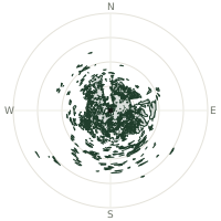
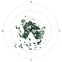
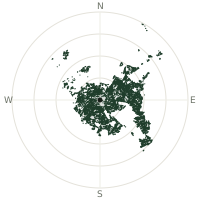
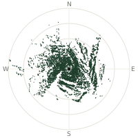
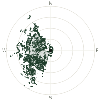
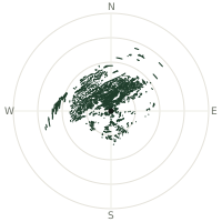
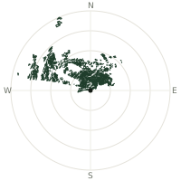
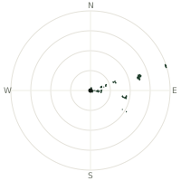
From Pico de Orizaba, the terrain-limited line of sight reaches up to 409 km. The single farthest piece of visible terrain lies 409 km to the east-southeast (bearing 122°), at 1,237 m elevation. These results account for Earth's curvature and standard atmospheric refraction, computed from 30-meter resolution Copernicus GLO-30 elevation data across 2,601,143 terrain samples.
Open the interactive visibility map →Visibility by direction
The horizon is most open toward the southeast, where sightlines run 316 km on average; terrain closes the view down fastest to the northwest, at 163 km.
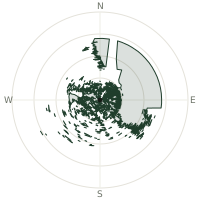
| N | 265 km | |
| NNE | 244 km | |
| NE | 286 km | |
| ENE | 286 km | |
| E | 281 km | |
| ESE | 270 km | |
| SE | 316 km | |
| SSE | 218 km | |
| S | 224 km | |
| SSW | 209 km | |
| SW | 248 km | |
| WSW | 280 km | |
| W | 177 km | |
| WNW | 177 km | |
| NW | 163 km | |
| NNW | 213 km |
Farthest named landmarks in view
1,767 named peaks, hills and headlands stand inside this viewshed. These are the farthest ones you could pick out on a clear day:
| Landmark | Visible distance | Direction | Elevation |
|---|---|---|---|
| Sierra Madre | 381 km | SE · 130° | 1,033 m |
| Cerro Las Tablas | 375 km | SE · 132° | 1,154 m |
| Tres Picos | 364 km | SE · 126° | 481 m |
| Cerro El Baúl | 355 km | WSW · 244° | 3,067 m |
| Cerro Muchacho | 355 km | WSW · 245° | 2,770 m |
| Cerro Mexcaltepec | 353 km | WSW · 245° | 2,683 m |
About Pico de Orizaba
Pico de Orizaba, at 5,636 metres (18,491 feet), is the highest peak in Mexico and the third-highest in all of North America, after Denali and Mount Logan. Its Aztec name, Citlaltépetl, translates as 'Star Mountain,' reflecting its prominence in pre-Columbian cosmology. The volcano rises between Veracruz and Puebla, its slopes covered in snow year-round at higher elevations, visible from great distances across central Mexico.
Did you know?
- Orizaba last erupted in 1846 and is still monitored as a potentially active volcano, even though its slopes have stayed quiet for well over a century.
- Its glaciated slopes make Orizaba a popular training climb for mountaineers preparing for bigger expeditions on peaks like Denali or Aconcagua.
- Its glaciers, shrinking but still present near the summit, rank among the southernmost in North America.
- The peak straddles the Veracruz-Puebla state border in central Mexico.
- Its snow-capped summit is visible from much of central Mexico on clear days.
Frequently asked questions
How far can you see from Pico de Orizaba?
On a clear day the terrain allows a line of sight of up to 409 km from Pico de Orizaba. The average visible distance across all 360 directions is 241 km. Atmospheric conditions (haze, humidity) usually reduce practical visibility below the terrain-limited maximum.
What is the farthest point visible from Pico de Orizaba?
The farthest terrain visible from Pico de Orizaba lies 409 km to the east-southeast, at an elevation of 1,237 m. Earth's curvature and atmospheric refraction are accounted for in this calculation.
How high is Pico de Orizaba?
The observation point at Pico de Orizaba sits at 5,602 m above sea level (Copernicus GLO-30 elevation model).
How is this visibility map calculated?
UpToWhere traces lines of sight in 360 directions from the observer using 30 m-resolution Copernicus terrain data, correcting for Earth curvature and standard atmospheric refraction. You can run the same analysis for any point on Earth with the free calculator.
Run your own analysis
Want to know what you can see from your house, a summit you're planning to climb, or a plot of land? UpToWhere computes the same 360° viewshed for any point on Earth in seconds — free.
Try the viewshed calculator