UpToWhere
What can you see from Park Güell?
Gaudí's garden city: whimsical terraces carved from Barcelona hillside.
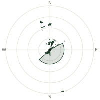
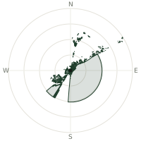
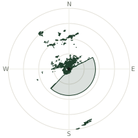
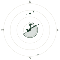
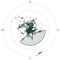
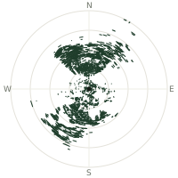
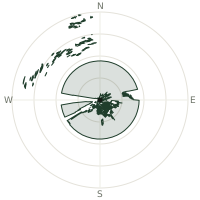
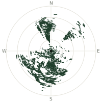
From Park Güell, the terrain-limited line of sight reaches up to 189 km. The single farthest piece of visible terrain lies 189 km to the south-southeast (bearing 161°), at 1,365 m elevation. These results account for Earth's curvature and standard atmospheric refraction, computed from 30-meter resolution Copernicus GLO-30 elevation data across 1,899,476 terrain samples.
Open the interactive visibility map →Visibility by direction
The horizon is most open toward the south-southeast, where sightlines run 66.0 km on average; terrain closes the view down fastest to the north-northeast, at 0.2 km.
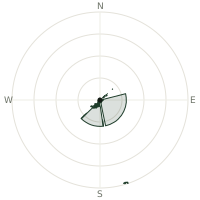
| N | 0.3 km | |
| NNE | 0.2 km | |
| NE | 2.6 km | |
| ENE | 7.4 km | |
| E | 56.3 km | |
| ESE | 56.3 km | |
| SE | 56.3 km | |
| SSE | 66.0 km | |
| S | 45.4 km | |
| SSW | 56.3 km | |
| SW | 39.1 km | |
| WSW | 4.7 km | |
| W | 3.3 km | |
| WNW | 2.8 km | |
| NW | 2.8 km | |
| NNW | 3.5 km |
Farthest named landmarks in view
10 named peaks, hills and headlands stand inside this viewshed. These are the farthest ones you could pick out on a clear day:
| Landmark | Visible distance | Direction | Elevation |
|---|---|---|---|
| Puig de Massanella | 188 km | SSE · 161° | 1,365 m |
| Penya de Migdia | 187 km | SSE · 163° | 1,356 m |
| Puig Major | 187 km | SSE · 163° | 1,436 m |
| el Corredor | 35.8 km | NE · 49° | 657 m |
| la Morella | 23.9 km | SW · 236° | 596 m |
| Sant Mateu | 18.3 km | NE · 53° | 499 m |
About Park Güell
Park Güell sprawls across Barcelona's hills, designed by Antoni Gaudí from 1900-1914 as a visionary residential development. Only two of 60 planned houses sold; Barcelona purchased the failed project for 3.2 million pesetas in 1922, converting it to a public park. UNESCO designated it a World Heritage Site in 1984.
Did you know?
- Construction lasted 1900-1914; opened to public 1926.
- Hypostyle Hall with 86 columns finished 1907.
- Gaudí covered many surfaces here in trencadís, a mosaic technique using broken ceramic tiles and glass scraps donated by local factories, most famously on the park's giant salamander sculpture.
- Gaudí himself lived in one of the park's only two built houses from 1906 to 1925 — not one he designed, but a show home by his colleague Francesc Berenguer, now the Gaudí House Museum.
- UNESCO World Heritage Site since 1984 (Works of Gaudí).
Frequently asked questions
How far can you see from Park Güell?
On a clear day the terrain allows a line of sight of up to 189 km from Park Güell. The average visible distance across all 360 directions is 25.2 km. Atmospheric conditions (haze, humidity) usually reduce practical visibility below the terrain-limited maximum.
What is the farthest point visible from Park Güell?
The farthest terrain visible from Park Güell lies 189 km to the south-southeast, at an elevation of 1,365 m. Earth's curvature and atmospheric refraction are accounted for in this calculation.
How high is Park Güell?
The observation point at Park Güell sits at 217 m above sea level (Copernicus GLO-30 elevation model).
How is this visibility map calculated?
UpToWhere traces lines of sight in 360 directions from the observer using 30 m-resolution Copernicus terrain data, correcting for Earth curvature and standard atmospheric refraction. You can run the same analysis for any point on Earth with the free calculator.
Run your own analysis
Want to know what you can see from your house, a summit you're planning to climb, or a plot of land? UpToWhere computes the same 360° viewshed for any point on Earth in seconds — free.
Try the viewshed calculator