UpToWhere
What can you see from Montjuïc?
Historians still argue whether its name honours Jupiter or a medieval Jewish cemetery.
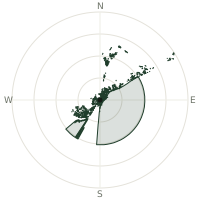
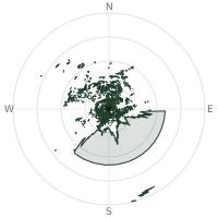
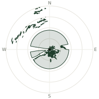
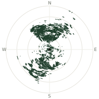
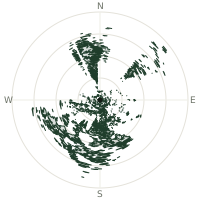
From Montjuïc, the terrain-limited line of sight reaches up to 183 km. The single farthest piece of visible terrain lies 183 km to the south-southeast (bearing 161°), at 1,167 m elevation. These results account for Earth's curvature and standard atmospheric refraction, computed from 30-meter resolution Copernicus GLO-30 elevation data across 1,894,420 terrain samples.
Open the interactive visibility map →Visibility by direction
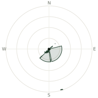
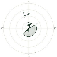
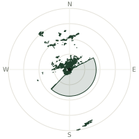
The horizon is most open toward the north, where sightlines run 69.7 km on average; terrain closes the view down fastest to the northwest, at 7.8 km.
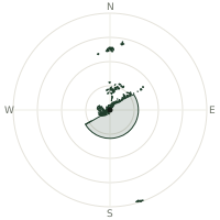
| N | 69.7 km | |
| NNE | 47.1 km | |
| NE | 43.4 km | |
| ENE | 55.5 km | |
| E | 53.7 km | |
| ESE | 53.7 km | |
| SE | 53.7 km | |
| SSE | 65.4 km | |
| S | 53.7 km | |
| SSW | 53.7 km | |
| SW | 53.7 km | |
| WSW | 26.2 km | |
| W | 22.1 km | |
| WNW | 15.7 km | |
| NW | 7.8 km | |
| NNW | 13.0 km |
Farthest named landmarks in view
83 named peaks, hills and headlands stand inside this viewshed. These are the farthest ones you could pick out on a clear day:
| Landmark | Visible distance | Direction | Elevation |
|---|---|---|---|
| Puig de ses Bassetes | 183 km | SSE · 162° | 1,212 m |
| Puig de Massanella | 182 km | SSE · 161° | 1,365 m |
| Penya de Migdia | 181 km | SSE · 163° | 1,356 m |
| Puig Major | 181 km | SSE · 163° | 1,436 m |
| Massif du Canigou | 131 km | N · 10° | 2,600 m |
| Pic du Canigou | 131 km | N · 10° | 2,784 m |
About Montjuïc
Montjuïc, a 173-metre hill over Barcelona's harbour, carries a name historians still debate: some trace it to a medieval Jewish cemetery on its slopes, others to the Latin Mons Jovis, hill of Jupiter. Its 17th-century castle spent much of its history as a military fortress and prison, and in October 1940 it was the site of the execution of Lluís Companys, the only democratically elected Catalan president ever put to death. Montjuïc was reshaped into parkland for the 1929 International Exposition and again for the 1992 Olympics, whose stadium and tower still crown its slopes.
Did you know?
- A medieval Jewish cemetery once stood on its slopes, used from at least the 11th century, and may be the source of the hill's name.
- Lluís Companys, president of Catalonia, was executed by firing squad in the castle's moat in October 1940.
- The hill's Olympic Stadium was originally built for the 1929 International Exposition, then renovated for the 1992 Summer Games.
- The white Montjuïc Communications Tower, built for the 1992 Olympics, was designed by architect Santiago Calatrava to double as a giant sundial.
- Separate cable cars have linked the harbour to the mountainside since 1931 and the park to the castle since 1970.
Frequently asked questions
How far can you see from Montjuïc?
On a clear day the terrain allows a line of sight of up to 183 km from Montjuïc. The average visible distance across all 360 directions is 43.1 km. Atmospheric conditions (haze, humidity) usually reduce practical visibility below the terrain-limited maximum.
What is the farthest point visible from Montjuïc?
The farthest terrain visible from Montjuïc lies 183 km to the south-southeast, at an elevation of 1,167 m. Earth's curvature and atmospheric refraction are accounted for in this calculation.
How high is Montjuïc?
The observation point at Montjuïc sits at 197 m above sea level (Copernicus GLO-30 elevation model).
How is this visibility map calculated?
UpToWhere traces lines of sight in 360 directions from the observer using 30 m-resolution Copernicus terrain data, correcting for Earth curvature and standard atmospheric refraction. You can run the same analysis for any point on Earth with the free calculator.
Run your own analysis
Want to know what you can see from your house, a summit you're planning to climb, or a plot of land? UpToWhere computes the same 360° viewshed for any point on Earth in seconds — free.
Try the viewshed calculator