UpToWhere
What can you see from Montserrat (Sant Jeroni)?
Its jagged silhouette is said to have inspired the Grail castle in Wagner's Parsifal.
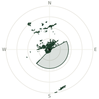
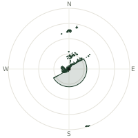
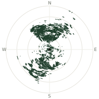
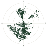
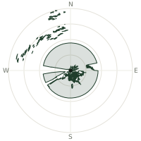
From Montserrat (Sant Jeroni), the terrain-limited line of sight reaches up to 226 km. The single farthest piece of visible terrain lies 226 km to the south-southeast (bearing 165°), at 1,027 m elevation. These results account for Earth's curvature and standard atmospheric refraction, computed from 30-meter resolution Copernicus GLO-30 elevation data across 2,097,697 terrain samples.
Open the interactive visibility map →Visibility by direction
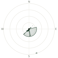
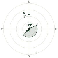
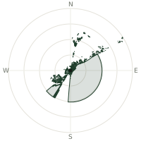
The horizon is most open toward the south-southeast, where sightlines run 196 km on average; terrain closes the view down fastest to the east-northeast, at 49.9 km.
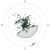
| N | 80.0 km | |
| NNE | 96.5 km | |
| NE | 70.1 km | |
| ENE | 49.9 km | |
| E | 95.1 km | |
| ESE | 133 km | |
| SE | 133 km | |
| SSE | 196 km | |
| S | 133 km | |
| SSW | 133 km | |
| SW | 115 km | |
| WSW | 69.1 km | |
| W | 86.1 km | |
| WNW | 110 km | |
| NW | 142 km | |
| NNW | 86.1 km |
Farthest named landmarks in view
337 named peaks, hills and headlands stand inside this viewshed. These are the farthest ones you could pick out on a clear day:
| Landmark | Visible distance | Direction | Elevation |
|---|---|---|---|
| Puig Galatzó | 226 km | SSE · 165° | 1,027 m |
| Puig de l'Ofre | 220 km | SSE · 158° | 1,093 m |
| Alfàbia | 220 km | SSE · 159° | 527 m |
| Cornador Gran | 220 km | SSE · 159° | 956 m |
| Puig de Massanella | 218 km | SSE · 156° | 1,365 m |
| Pla d'Almallutx | 217 km | SSE · 157° | 969 m |
About Montserrat (Sant Jeroni)
Montserrat is a serrated ridge of pink conglomerate rock rising abruptly from the plain northwest of Barcelona, its highest point, Sant Jeroni, reaching 1,236 metres. Since the 11th century it has held the Benedictine monastery of Santa Maria de Montserrat, home to La Moreneta, a Black Madonna legend says shepherds found in a cave in 880 AD, and to one of Europe's oldest boys' choirs. Its strange, rounded peaks, worn over millions of years into shapes resembling fingers and limbs, are widely believed to have inspired the Grail castle in Wagner's opera Parsifal.
Did you know?
- The Black Madonna, La Moreneta, has been Catalonia's patron and religious symbol since at least the 12th century.
- The Escolania de Montserrat boys' choir traces its origins to at least the 13th century, making it one of Europe's oldest.
- Montserrat's odd rounded pinnacles are conglomerate rock, pebbles and sand cemented together, unlike the granite or limestone typical of nearby ranges.
- Wagner's opera Parsifal is widely thought to place its fictional Grail castle, Montsalvat, on a mountain modelled on Montserrat.
- Two funiculars, dating to 1918 and 1929, still carry visitors from the monastery up to nearby chapels and viewpoints.
Frequently asked questions
How far can you see from Montserrat (Sant Jeroni)?
On a clear day the terrain allows a line of sight of up to 226 km from Montserrat (Sant Jeroni). The average visible distance across all 360 directions is 108 km. Atmospheric conditions (haze, humidity) usually reduce practical visibility below the terrain-limited maximum.
What is the farthest point visible from Montserrat (Sant Jeroni)?
The farthest terrain visible from Montserrat (Sant Jeroni) lies 226 km to the south-southeast, at an elevation of 1,027 m. Earth's curvature and atmospheric refraction are accounted for in this calculation.
How high is Montserrat (Sant Jeroni)?
The observation point at Montserrat (Sant Jeroni) sits at 1,211 m above sea level (Copernicus GLO-30 elevation model).
How is this visibility map calculated?
UpToWhere traces lines of sight in 360 directions from the observer using 30 m-resolution Copernicus terrain data, correcting for Earth curvature and standard atmospheric refraction. You can run the same analysis for any point on Earth with the free calculator.
Run your own analysis
Want to know what you can see from your house, a summit you're planning to climb, or a plot of land? UpToWhere computes the same 360° viewshed for any point on Earth in seconds — free.
Try the viewshed calculator