UpToWhere
What can you see from Mount Washburn (Yellowstone)?
Named for the leader of Yellowstone's first major expedition, who reached the summit on 29 August 1870.
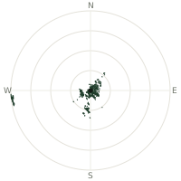
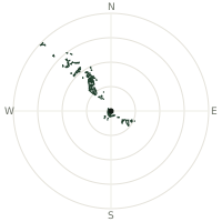
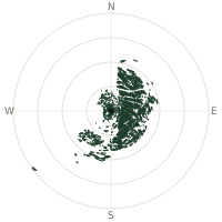
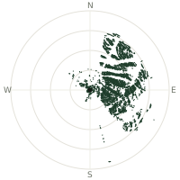
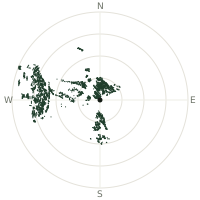
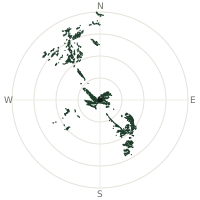
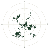
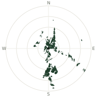
From Mount Washburn (Yellowstone), the terrain-limited line of sight reaches up to 222 km. The single farthest piece of visible terrain lies 222 km to the west-southwest (bearing 245°), at 3,279 m elevation. These results account for Earth's curvature and standard atmospheric refraction, computed from 30-meter resolution Copernicus GLO-30 elevation data across 2,356,019 terrain samples.
Open the interactive visibility map →Visibility by direction
The horizon is most open toward the west-southwest, where sightlines run 104 km on average; terrain closes the view down fastest to the north-northwest, at 47.5 km.
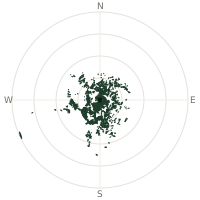
| N | 51.4 km | |
| NNE | 52.8 km | |
| NE | 63.7 km | |
| ENE | 64.3 km | |
| E | 49.4 km | |
| ESE | 55.1 km | |
| SE | 71.5 km | |
| SSE | 86.3 km | |
| S | 92.9 km | |
| SSW | 83.5 km | |
| SW | 58.9 km | |
| WSW | 104 km | |
| W | 76.0 km | |
| WNW | 51.1 km | |
| NW | 75.7 km | |
| NNW | 47.5 km |
Farthest named landmarks in view
202 named peaks, hills and headlands stand inside this viewshed. These are the farthest ones you could pick out on a clear day:
| Landmark | Visible distance | Direction | Elevation |
|---|---|---|---|
| Saddle Mountain | 222 km | WSW · 245° | 3,279 m |
| Tyler Peak | 221 km | WSW · 247° | 3,252 m |
| Red Conglomerate Peaks | 175 km | W · 259° | 3,108 m |
| Pyramid Peak | 149 km | S · 181° | 3,382 m |
| Table Mountain | 144 km | S · 185° | 3,025 m |
| Sheep Mountain | 139 km | S · 183° | 3,418 m |
About Mount Washburn (Yellowstone)
Mount Washburn, at approximately 10,327 feet in Yellowstone National Park, was climbed and named on 29 August 1870 by members of the Washburn-Langford-Doane Expedition. Led by Henry D. Washburn with U.S. Army escort under Lieutenant Gustavus C. Doane, the party explored northwestern Wyoming in the summer of 1870 and later helped establish Yellowstone as the world's first national park two years later. From the summit, Doane made navigational observations that corrected prior map inaccuracies and helped define the watershed that became the park's northern boundary.
Did you know?
- Expedition member Nathaniel Langford went on to become Yellowstone's first superintendent in 1872, serving without pay or federal funding for five years.
- The party struggled through dense timber, steep slopes, and snowfields during the challenging ascent.
- Doane's summit bearings and sketches contributed significantly to the mapping of the Yellowstone region.
- The expedition's observations of geysers, including Old Faithful's regular eruptions, informed later park management.
- Two years after this expedition, President Ulysses S. Grant signed legislation creating Yellowstone National Park in 1872.
Frequently asked questions
How far can you see from Mount Washburn (Yellowstone)?
On a clear day the terrain allows a line of sight of up to 222 km from Mount Washburn (Yellowstone). The average visible distance across all 360 directions is 67.7 km. Atmospheric conditions (haze, humidity) usually reduce practical visibility below the terrain-limited maximum.
What is the farthest point visible from Mount Washburn (Yellowstone)?
The farthest terrain visible from Mount Washburn (Yellowstone) lies 222 km to the west-southwest, at an elevation of 3,279 m. Earth's curvature and atmospheric refraction are accounted for in this calculation.
How high is Mount Washburn (Yellowstone)?
The observation point at Mount Washburn (Yellowstone) sits at 3,132 m above sea level (Copernicus GLO-30 elevation model).
How is this visibility map calculated?
UpToWhere traces lines of sight in 360 directions from the observer using 30 m-resolution Copernicus terrain data, correcting for Earth curvature and standard atmospheric refraction. You can run the same analysis for any point on Earth with the free calculator.
Run your own analysis
Want to know what you can see from your house, a summit you're planning to climb, or a plot of land? UpToWhere computes the same 360° viewshed for any point on Earth in seconds — free.
Try the viewshed calculator