UpToWhere
What can you see from Devils Tower?
It's the neck of an ancient volcano, and aliens landed on it in 1977 (in the movies).
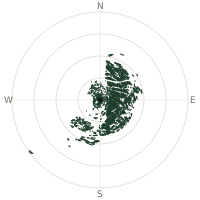
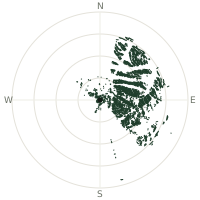
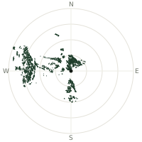
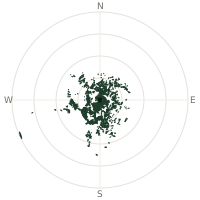
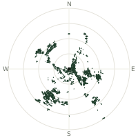
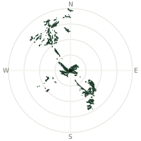
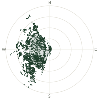
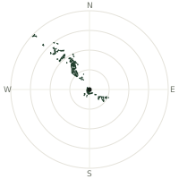
From Devils Tower, the terrain-limited line of sight reaches up to 198 km. The single farthest piece of visible terrain lies 198 km to the west (bearing 266°), at 3,488 m elevation. These results account for Earth's curvature and standard atmospheric refraction, computed from 30-meter resolution Copernicus GLO-30 elevation data across 2,128,988 terrain samples.
Open the interactive visibility map →Visibility by direction
The horizon is most open toward the west, where sightlines run 59.6 km on average; terrain closes the view down fastest to the north-northwest, at 4.2 km.
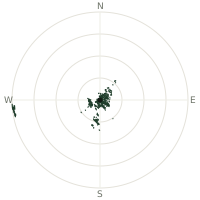
| N | 12.6 km | |
| NNE | 17.2 km | |
| NE | 36.5 km | |
| ENE | 24.4 km | |
| E | 21.5 km | |
| ESE | 20.1 km | |
| SE | 19.5 km | |
| SSE | 18.6 km | |
| S | 34.2 km | |
| SSW | 36.9 km | |
| SW | 25.9 km | |
| WSW | 27.7 km | |
| W | 59.6 km | |
| WNW | 5.3 km | |
| NW | 4.4 km | |
| NNW | 4.2 km |
Farthest named landmarks in view
21 named peaks, hills and headlands stand inside this viewshed. These are the farthest ones you could pick out on a clear day:
| Landmark | Visible distance | Direction | Elevation |
|---|---|---|---|
| Cloud Peak | 197 km | W · 264° | 4,017 m |
| Mount Woolsey | 197 km | W · 265° | 3,942 m |
| Black Tooth Mountain | 197 km | W · 265° | 3,732 m |
| Mather Peaks | 196 km | W · 262° | 3,784 m |
| Penrose Peak | 194 km | W · 265° | 3,781 m |
| Bighorn Peak | 194 km | W · 260° | 3,755 m |
About Devils Tower
Devils Tower is what's left after softer surrounding rock eroded away from an intrusion of magma that cooled roughly 40 million years ago, leaving behind a nearly 400-metre monolith fluted into hexagonal columns. In 1906, Theodore Roosevelt made it the first national monument in US history under the brand-new Antiquities Act. Several Plains tribes, including the Lakota, Kiowa, and Cheyenne, consider it sacred and call it Bear Lodge, with origin stories describing the vertical grooves as claw marks left by a giant bear.
Did you know?
- The tower's hexagonal columns formed as cooling magma contracted and cracked along consistent 120-degree angles, the same process behind Ireland's Giant's Causeway.
- Its first recorded ascent, in 1893, used a wooden ladder built by driving stakes into a vertical crack, since removed but partially visible.
- Several tribes ask climbers to voluntarily avoid the tower each June, a culturally significant month for ceremonies at the site.
- Steven Spielberg filmed the climactic alien-contact scenes of "Close Encounters of the Third Kind" here in 1977, turning it into an unlikely pop-culture icon.
- Today it's one of the most popular crack-climbing destinations in North America, with more than 200 established routes up its columns.
Frequently asked questions
How far can you see from Devils Tower?
On a clear day the terrain allows a line of sight of up to 198 km from Devils Tower. The average visible distance across all 360 directions is 23.1 km. Atmospheric conditions (haze, humidity) usually reduce practical visibility below the terrain-limited maximum.
What is the farthest point visible from Devils Tower?
The farthest terrain visible from Devils Tower lies 198 km to the west, at an elevation of 3,488 m. Earth's curvature and atmospheric refraction are accounted for in this calculation.
How high is Devils Tower?
The observation point at Devils Tower sits at 1,408 m above sea level (Copernicus GLO-30 elevation model).
How is this visibility map calculated?
UpToWhere traces lines of sight in 360 directions from the observer using 30 m-resolution Copernicus terrain data, correcting for Earth curvature and standard atmospheric refraction. You can run the same analysis for any point on Earth with the free calculator.
Run your own analysis
Want to know what you can see from your house, a summit you're planning to climb, or a plot of land? UpToWhere computes the same 360° viewshed for any point on Earth in seconds — free.
Try the viewshed calculator