UpToWhere
What can you see from Bryce Point (Bryce Canyon)?
It's called a canyon, but geologists insist it's something else entirely.
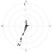
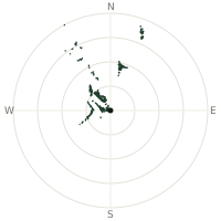
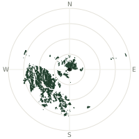
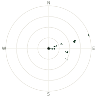
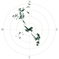
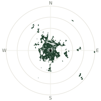
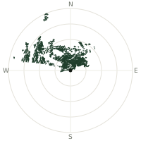
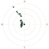
From Bryce Point (Bryce Canyon), the terrain-limited line of sight reaches up to 166 km. The single farthest piece of visible terrain lies 166 km to the east-southeast (bearing 122°), at 2,289 m elevation. These results account for Earth's curvature and standard atmospheric refraction, computed from 30-meter resolution Copernicus GLO-30 elevation data across 2,286,595 terrain samples.
Open the interactive visibility map →Visibility by direction
The horizon is most open toward the south, where sightlines run 116 km on average; terrain closes the view down fastest to the southeast, at 1.1 km.
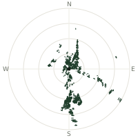
| N | 40.4 km | |
| NNE | 57.8 km | |
| NE | 35.8 km | |
| ENE | 31.1 km | |
| E | 30.5 km | |
| ESE | 97.0 km | |
| SE | 1.1 km | |
| SSE | 45.7 km | |
| S | 116 km | |
| SSW | 21.0 km | |
| SW | 13.0 km | |
| WSW | 16.2 km | |
| W | 21.9 km | |
| WNW | 40.3 km | |
| NW | 11.4 km | |
| NNW | 44.8 km |
Farthest named landmarks in view
64 named peaks, hills and headlands stand inside this viewshed. These are the farthest ones you could pick out on a clear day:
| Landmark | Visible distance | Direction | Elevation |
|---|---|---|---|
| Tall Mountain | 166 km | ESE · 123° | 2,307 m |
| Roosevelt Point | 155 km | S · 173° | 2,585 m |
| Tritle Peak | 154 km | S · 173° | 2,514 m |
| Saddle Mountain | 145 km | S · 172° | 2,564 m |
| Navajo Begay | 134 km | ESE · 116° | 2,129 m |
| Mount Hillers | 133 km | ENE · 76° | 3,258 m |
About Bryce Point (Bryce Canyon)
Despite the name, Bryce Canyon isn't a canyon at all: it's a series of natural amphitheaters carved into the eastern edge of the Paunsaugunt Plateau by frost and rain rather than a river. Freeze-thaw cycles, sometimes over 200 a year, wedge apart the rock while mildly acidic rainwater dissolves the softer limestone, leaving behind the thousands of spindly hoodoos the park is known for. The area takes its name from Ebenezer Bryce, a Mormon settler who reportedly called it "a helluva place to lose a cow."
Did you know?
- Many hoodoos are capped with a harder, erosion-resistant rock that shields the softer stone beneath — when a cap finally falls off, the spire beneath erodes away within a few years.
- The plateau here can see more than 200 freeze-thaw cycles a year, the main force splitting the rock into narrow fins and then spires.
- The main amphitheater visible from Bryce Point stretches about 19 kilometres long and drops roughly 240 metres from rim to floor.
- Ebenezer Bryce, the Mormon carpenter the park is named after, only lived in the area for about five years before moving on.
- Bryce Point looks north across the full length of the amphitheater, making it one of the park's most popular sunrise viewpoints.
Frequently asked questions
How far can you see from Bryce Point (Bryce Canyon)?
On a clear day the terrain allows a line of sight of up to 166 km from Bryce Point (Bryce Canyon). The average visible distance across all 360 directions is 38.9 km. Atmospheric conditions (haze, humidity) usually reduce practical visibility below the terrain-limited maximum.
What is the farthest point visible from Bryce Point (Bryce Canyon)?
The farthest terrain visible from Bryce Point (Bryce Canyon) lies 166 km to the east-southeast, at an elevation of 2,289 m. Earth's curvature and atmospheric refraction are accounted for in this calculation.
How high is Bryce Point (Bryce Canyon)?
The observation point at Bryce Point (Bryce Canyon) sits at 2,547 m above sea level (Copernicus GLO-30 elevation model).
How is this visibility map calculated?
UpToWhere traces lines of sight in 360 directions from the observer using 30 m-resolution Copernicus terrain data, correcting for Earth curvature and standard atmospheric refraction. You can run the same analysis for any point on Earth with the free calculator.
Run your own analysis
Want to know what you can see from your house, a summit you're planning to climb, or a plot of land? UpToWhere computes the same 360° viewshed for any point on Earth in seconds — free.
Try the viewshed calculator