UpToWhere
What can you see from Angels Landing (Zion)?
Named because only an angel could land there; hikers now need a permit.
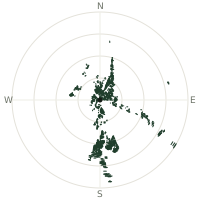
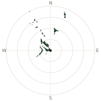
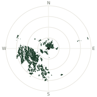
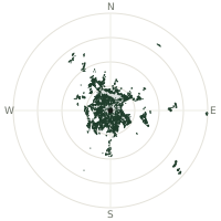
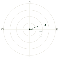
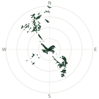
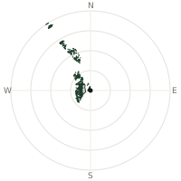
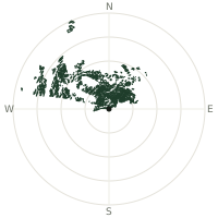
From Angels Landing (Zion), the terrain-limited line of sight reaches up to 24.7 km. The single farthest piece of visible terrain lies 24.7 km to the north (bearing 357°), at 2,645 m elevation. These results account for Earth's curvature and standard atmospheric refraction, computed from 30-meter resolution Copernicus GLO-30 elevation data across 2,166,647 terrain samples.
Open the interactive visibility map →Visibility by direction
The horizon is most open toward the south-southwest, where sightlines run 12.6 km on average; terrain closes the view down fastest to the west, at 0.6 km.
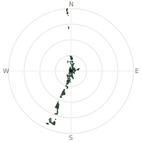
| N | 5.3 km | |
| NNE | 2.5 km | |
| NE | 1.6 km | |
| ENE | 2.3 km | |
| E | 2.1 km | |
| ESE | 1.5 km | |
| SE | 1.2 km | |
| SSE | 1.9 km | |
| S | 3.3 km | |
| SSW | 12.6 km | |
| SW | 1.7 km | |
| WSW | 0.6 km | |
| W | 0.6 km | |
| WNW | 0.7 km | |
| NW | 0.9 km | |
| NNW | 1.9 km |
Farthest named landmarks in view
7 named peaks, hills and headlands stand inside this viewshed. These are the farthest ones you could pick out on a clear day:
| Landmark | Visible distance | Direction | Elevation |
|---|---|---|---|
| Eagle Crags | 16.7 km | SSW · 200° | 1,914 m |
| The Watchman | 9.8 km | SSW · 196° | 1,958 m |
| Bridge Mountain | 7.3 km | SSW · 192° | 2,036 m |
| Mount Moroni | 3.2 km | SSW · 203° | 1,654 m |
| Lady Mountain | 2.3 km | SW · 221° | 2,110 m |
| Red Arch Mountain | 1.6 km | S · 182° | 1,524 m |
About Angels Landing (Zion)
A Methodist minister named this narrow sandstone spine in 1916, reasoning that only an angel could possibly land on its summit. The final half mile follows a knife-edge ridge with 1,000-foot drops on both sides, aided since the 1920s by a chain bolted into the rock for hikers to grip. So many people wanted to attempt it that Zion National Park introduced a lottery permit system in 2022 just for the chained section.
Did you know?
- Hikers gain about 450 metres of elevation from the canyon floor to the summit, most of it in the final steep mile.
- The chains along the last stretch date back to the 1920s, decades before modern climbing gear made the exposure feel any less real.
- Since April 2022, a lottery permit has been required to go beyond Scout Lookout, the point where the real exposure begins.
- The name comes from a 1916 remark by a visiting minister, who said the summit was so sheer only an angel could land on it.
- From the top, the Virgin River curls along the canyon floor directly below, with the sheer face of the Great White Throne rising opposite.
Frequently asked questions
How far can you see from Angels Landing (Zion)?
On a clear day the terrain allows a line of sight of up to 24.7 km from Angels Landing (Zion). The average visible distance across all 360 directions is 2.5 km. Atmospheric conditions (haze, humidity) usually reduce practical visibility below the terrain-limited maximum.
What is the farthest point visible from Angels Landing (Zion)?
The farthest terrain visible from Angels Landing (Zion) lies 24.7 km to the north, at an elevation of 2,645 m. Earth's curvature and atmospheric refraction are accounted for in this calculation.
How high is Angels Landing (Zion)?
The observation point at Angels Landing (Zion) sits at 1,656 m above sea level (Copernicus GLO-30 elevation model).
How is this visibility map calculated?
UpToWhere traces lines of sight in 360 directions from the observer using 30 m-resolution Copernicus terrain data, correcting for Earth curvature and standard atmospheric refraction. You can run the same analysis for any point on Earth with the free calculator.
Run your own analysis
Want to know what you can see from your house, a summit you're planning to climb, or a plot of land? UpToWhere computes the same 360° viewshed for any point on Earth in seconds — free.
Try the viewshed calculator