UpToWhere
What can you see from Uluru?
A sacred monolith held by the Anangu people for tens of thousands of years; climbing banned since 2019.
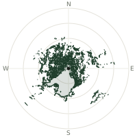
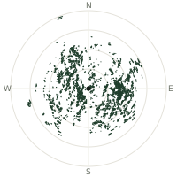
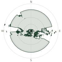
From Uluru, the terrain-limited line of sight reaches up to 145 km. The single farthest piece of visible terrain lies 145 km to the southeast (bearing 129°), at 1,109 m elevation. These results account for Earth's curvature and standard atmospheric refraction, computed from 30-meter resolution Copernicus GLO-30 elevation data across 2,037,532 terrain samples.
Open the interactive visibility map →Visibility by direction
The horizon is most open toward the south-southeast, where sightlines run 112 km on average; terrain closes the view down fastest to the west-northwest, at 58.9 km.
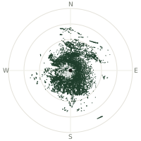
| N | 106 km | |
| NNE | 97.5 km | |
| NE | 90.2 km | |
| ENE | 96.9 km | |
| E | 69.5 km | |
| ESE | 70.9 km | |
| SE | 101 km | |
| SSE | 112 km | |
| S | 85.4 km | |
| SSW | 64.2 km | |
| SW | 81.4 km | |
| WSW | 71.1 km | |
| W | 77.2 km | |
| WNW | 58.9 km | |
| NW | 67.4 km | |
| NNW | 83.3 km |
Farthest named landmarks in view
15 named peaks, hills and headlands stand inside this viewshed. These are the farthest ones you could pick out on a clear day:
| Landmark | Visible distance | Direction | Elevation |
|---|---|---|---|
| Alalkanya Hills | 140 km | SE · 131° | 1,118 m |
| Maratjara | 129 km | SSE · 147° | 1,417 m |
| Ngarutjaranya | 129 km | SSE · 147° | 1,417 m |
| Aliwanyiwanyinya | 129 km | SSE · 147° | 1,417 m |
| Mount Woodroffe | 129 km | SSE · 147° | 1,440 m |
| Mount Phillips | 118 km | W · 277° | 708 m |
About Uluru
Uluru rises 348 metres from the Australian outback and is sacred to the Anangu, the Indigenous people of the region, for tens of thousands of years. Climbing Uluru was never permitted under Tjukurpa (Anangu law and culture), but tourists began scaling it after the first road was built in 1948. The Board of Management, voting unanimously, closed the climb on 26 October 2019—the 34th anniversary of the park's handback to Indigenous ownership. The ban respects cultural significance and protects the site from environmental damage. At least 37 climbers have died on the rock since 1948, mostly from medical events.
Did you know?
- Uluru glows deep red at sunrise and sunset as iron minerals in its sandstone oxidise, or rust, when exposed to the air and light.
- Signs around the base ask visitors not to photograph certain sacred sections of the rock, out of respect for Anangu spiritual law, even though photographing Uluru overall is welcome.
- The rock is estimated to be around 550 million years old, formed from sediment eroded off mountain ranges that no longer exist.
- Indigenous Australians celebrated with song and dance as the final climbers descended.
- The ban protects the sacred site from environmental damage and honours Anangu sovereignty.
Frequently asked questions
How far can you see from Uluru?
On a clear day the terrain allows a line of sight of up to 145 km from Uluru. The average visible distance across all 360 directions is 83.3 km. Atmospheric conditions (haze, humidity) usually reduce practical visibility below the terrain-limited maximum.
What is the farthest point visible from Uluru?
The farthest terrain visible from Uluru lies 145 km to the southeast, at an elevation of 1,109 m. Earth's curvature and atmospheric refraction are accounted for in this calculation.
How high is Uluru?
The observation point at Uluru sits at 866 m above sea level (Copernicus GLO-30 elevation model).
How is this visibility map calculated?
UpToWhere traces lines of sight in 360 directions from the observer using 30 m-resolution Copernicus terrain data, correcting for Earth curvature and standard atmospheric refraction. You can run the same analysis for any point on Earth with the free calculator.
Run your own analysis
Want to know what you can see from your house, a summit you're planning to climb, or a plot of land? UpToWhere computes the same 360° viewshed for any point on Earth in seconds — free.
Try the viewshed calculator