UpToWhere
What can you see from Niagara Falls?
681,750 gallons per second plunge: Horseshoe Falls, nature's supreme cascade.
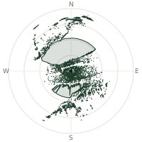
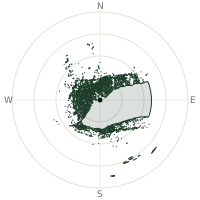
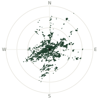
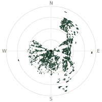
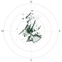
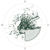
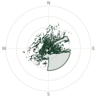
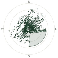
From Niagara Falls, the terrain-limited line of sight reaches up to 6.4 km. The single farthest piece of visible terrain lies 6.4 km to the east-southeast (bearing 123°), at 199 m elevation. These results account for Earth's curvature and standard atmospheric refraction, computed from 30-meter resolution Copernicus GLO-30 elevation data across 1,886,719 terrain samples.
Open the interactive visibility map →Visibility by direction
The horizon is most open toward the southeast, where sightlines run 3.2 km on average; terrain closes the view down fastest to the west, at 0.1 km.
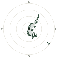
| N | 0.5 km | |
| NNE | 1.4 km | |
| NE | 2.6 km | |
| ENE | 1.8 km | |
| E | 0.9 km | |
| ESE | 1.0 km | |
| SE | 3.2 km | |
| SSE | 1.8 km | |
| S | 1.4 km | |
| SSW | 0.7 km | |
| SW | 0.2 km | |
| WSW | 0.1 km | |
| W | 0.1 km | |
| WNW | 0.1 km | |
| NW | 0.1 km | |
| NNW | 0.3 km |
About Niagara Falls
Niagara Falls channels an astounding volume of water across three interconnected waterfalls, with the Horseshoe Falls bearing the heaviest torrent. Over 681,750 gallons per second surge over the Horseshoe crest during peak hours, creating one of Earth's most dramatic water displays and a borderland symbol of raw hydroelectric power.
Did you know?
- Much of the Niagara River's flow is quietly diverted through tunnels to hydroelectric stations under a 1950 US-Canada treaty — the falls you see, especially at night and in winter, are deliberately a reduced fraction of the river's true volume.
- 168,000 cubic meters of water per minute across all three falls
- Peak flow recorded at 225,000 cubic feet per second
- Summer minimum 2,800 cubic meters per second maintained
- Horseshoe Falls captures 90% of total summer flow
Frequently asked questions
How far can you see from Niagara Falls?
On a clear day the terrain allows a line of sight of up to 6.4 km from Niagara Falls. The average visible distance across all 360 directions is 1.0 km. Atmospheric conditions (haze, humidity) usually reduce practical visibility below the terrain-limited maximum.
What is the farthest point visible from Niagara Falls?
The farthest terrain visible from Niagara Falls lies 6.4 km to the east-southeast, at an elevation of 199 m. Earth's curvature and atmospheric refraction are accounted for in this calculation.
How high is Niagara Falls?
The observation point at Niagara Falls sits at 167 m above sea level (Copernicus GLO-30 elevation model).
How is this visibility map calculated?
UpToWhere traces lines of sight in 360 directions from the observer using 30 m-resolution Copernicus terrain data, correcting for Earth curvature and standard atmospheric refraction. You can run the same analysis for any point on Earth with the free calculator.
Run your own analysis
Want to know what you can see from your house, a summit you're planning to climb, or a plot of land? UpToWhere computes the same 360° viewshed for any point on Earth in seconds — free.
Try the viewshed calculator