 UpToWhere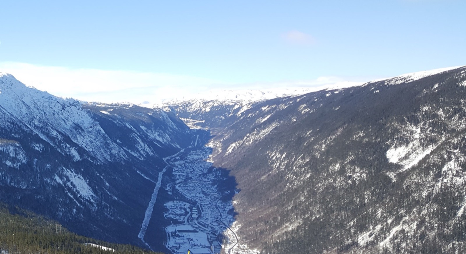
Photo: Bengt-Inge Larsson, CC BY-SA 4.0, via Wikimedia Commons (cropped).

Every winter, the same story runs in the Swiss and Norwegian press. A village at the bottom of a deep valley watches the sun disappear behind a mountain in October and does not see it again until February or March. In Rjukan, Norway they built a giant mirror on the mountainside to bounce a patch of sunlight onto the town square. In Viganella, Italy they did the same in 2006, and every 2 February the village still celebrates the sun's return. The stories are wonderful, and they are always told the same way: as folklore, with a number attached that nobody has checked.
Rjukan is dark "about six months." Viganella loses the sun for 83 days. Bristen, in Uri, is "the Schattenloch of Switzerland." Where do those numbers come from? Almost always from local memory, or from a single hobbyist website that the newspapers quote and re-quote. Nobody has ever put these villages on the same ruler: computed the same way, from the same data, so you can actually rank them.
So we did. We took the terrain engine behind UpToWhere, and for thousands of mountain settlements we computed, day by day for a full year, whether the sun ever clears the surrounding terrain at all. Not almanac sunrise: the real moment the sun crests the ridge, as seen from that exact spot, on 30 m Copernicus elevation data. Then we counted the days it never does.
What "sunless" actually means
Start with the thing every weather app gets wrong. When your phone says the sun rises at 08:11, it means the sun crosses the flat sea-level horizon at 08:11. In a valley, that is not when you see it. The sun has to climb high enough to clear the mountain to your southeast first, and in a deep valley in December, that can take another two or three hours, if it happens at all.
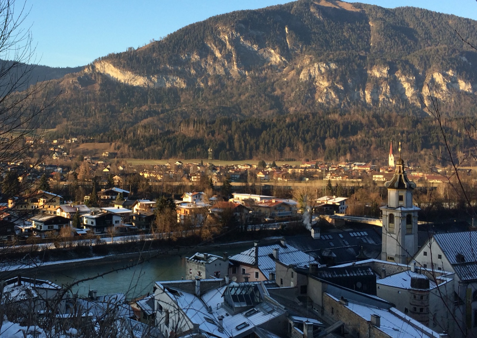
Photo: Dr Bob Hall, CC BY-SA 2.0, via Wikimedia Commons (cropped).
.jpg)
We measured this for the three famous villages first, standing the pin on each one's gazetteer point, and the engine reproduces the folklore closely:
| Village | The published claim | What the terrain says |
|---|---|---|
| Viganella (IT) | 83 days, 11 Nov → 2 Feb | 93 days, 5 Nov → 6 Feb |
| Bristen (CH) | ~139 days, 10 Oct → 26 Feb | 132 days, 17 Oct → 26 Feb |
| Rjukan (NO) | "six months," ~Sep → Mar | 177 days, 24 Sep → 20 Mar |
(Throughout this article, the two dates are the first day the sun fails to clear the terrain and the first day it clears it again.)
Look at Viganella's second column. The engine, running blind on nothing but elevation data, puts the sun's return on 6 February, four days from the festa del sole the village has timed to the sun's reappearance for generations, since long before anyone computed anything. We tuned nothing to get that; the date falls straight out of the terrain. Which is why we trust the same method on the villages nobody has measured.
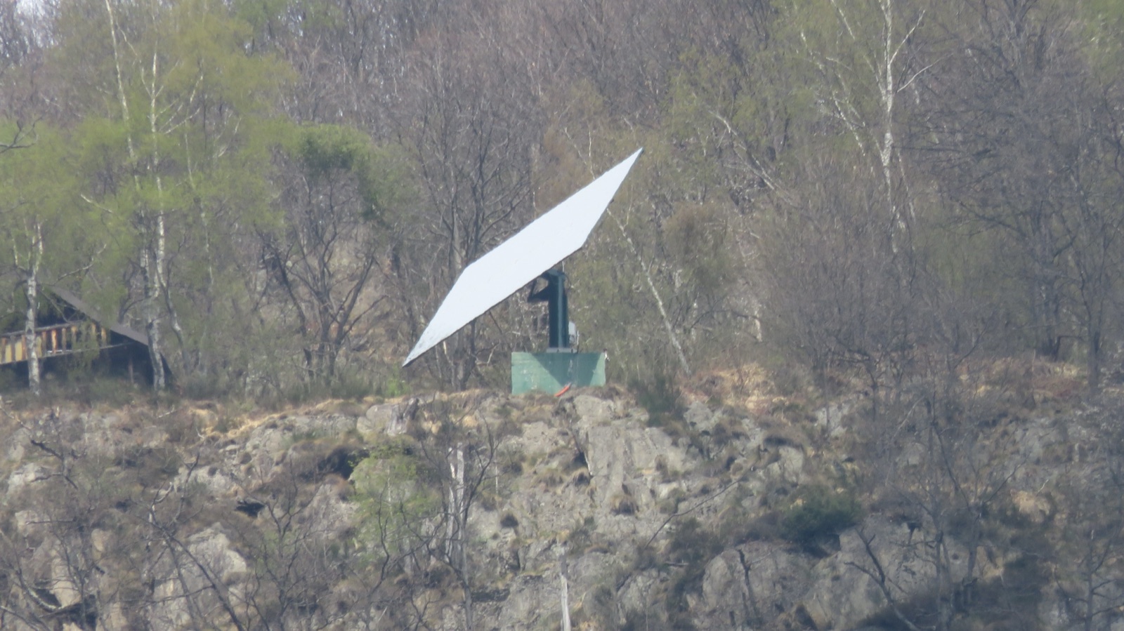
Photo: Francoerbi, CC BY-SA 4.0, via Wikimedia Commons.

The mirror is not a monument, either. An electrical surge burned out the electronics that aim it, and the village spent two winters with the thing frozen in place before the commune and a sponsor got it tracking again for the winter of 2025–26. Forty square metres of steel, aimed by computer, to light one square in a village of two hundred people.
One thing to know before you trust any of this for your own street: Copernicus is a bare-terrain model. It sees mountains and valleys, not buildings or trees. In a city, your horizon is the building across the street, and this analysis says nothing useful. In a mountain village, the horizon is the mountain, which is exactly why the method fits these places and only these places.
Why the "village centre" is a lie
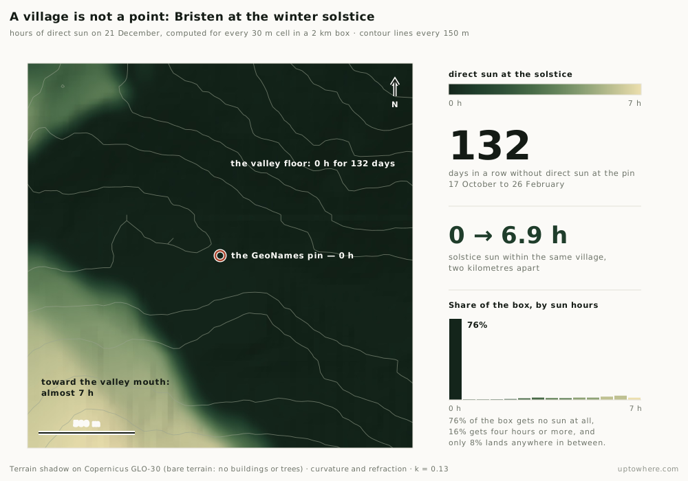
The first thing a proper computation turns up is a problem every published figure has quietly ignored: there is no single "sun time" for a village.
We sampled the winter-solstice sun across a two-kilometre box around Bristen (roughly the span of the inhabited valley floor), and the daily sunshine ranged from zero hours to almost seven, depending on which house you stood at. Move a few hundred metres toward the valley mouth and the mountain that blocks you drops below your sightline; move back toward the headwall and it swallows the whole day.
Nesslau, in the Toggenburg, makes the point even more sharply. The Swiss weather service lists it among the country's Schattenlöcher (shadow holes) at 132 sunless days. Yet drop a pin on the village centre and our engine finds it gets nearly five hours of sun on the solstice. Both are correct. The 132-day figure belongs to a specific spot on the shaded valley floor; the church, a few hundred metres away and slightly higher, sees the sun all winter. A village is not a point, and "the village loses the sun" is really "this part of the village loses the sun."
So every number in this article is tied to one explicit, stated point: the GeoNames populated-place coordinate for each settlement, the same standard centroid for every village, so the ranking is consistent and anyone can reproduce it. Where that centroid sits on a sunnier shoulder than the shadowed floor nearby, the village's true worst spot loses more sun than we credit. That is not a footnote. It is the difference between a measurement and a legend.
The ones nobody has named
The famous villages are famous mostly for having built a mirror. When you compute the whole mountain chain instead of just the places that made the news, the top of the leaderboard fills up with names nobody has printed.
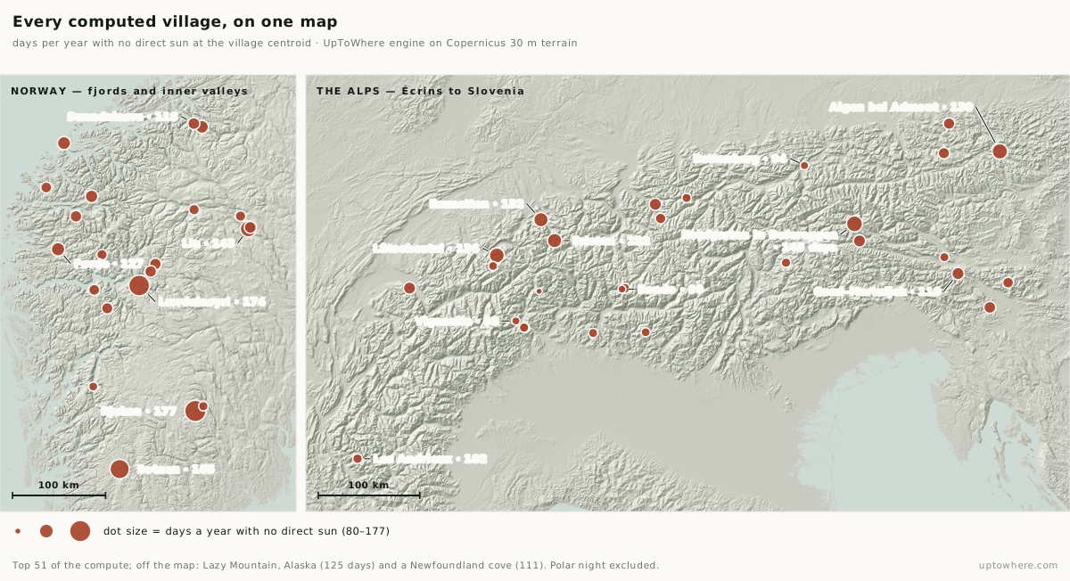
Ranked by days per winter with no direct sun at the village centre, the towns at the top are Norwegian: deep fjord-heads and valleys where a low northern sun and a high southern wall combine. Rjukan, the mirror town, tops the list and earns its reputation. The villages packed in just behind it have never been in a newspaper:
| # | Village | Country | Days without sun | Sun leaves → returns |
|---|---|---|---|---|
| 1 | Rjukan | 🇳🇴 NO | 177 | 24 Sep → 20 Mar |
| 2 | Lærdalsøyri | 🇳🇴 NO | 174 | 26 Sep → 19 Mar |
| 3 | Botnen | 🇳🇴 NO | 165 | 30 Sep → 14 Mar |
| 4 | Hopfgarten in Defereggen | 🇦🇹 AT | 143 | 11 Oct → 3 Mar |
| 4 | Lia | 🇳🇴 NO | 143 | 11 Oct → 3 Mar |
| 6 | Aigen bei Admont | 🇦🇹 AT | 139 | 13 Oct → 1 Mar |
| 7 | Lütschental | 🇨🇭 CH | 136 | 15 Oct → 28 Feb |
| 8 | Emmetten | 🇨🇭 CH | 132 | 17 Oct → 26 Feb |
| 8 | Bristen | 🇨🇭 CH | 132 | 17 Oct → 26 Feb |
| 10 | Førde | 🇳🇴 NO | 127 | 19 Oct → 23 Feb |
(The full computed table of all 51 is at the end of this article. Excludes places above the Arctic Circle, where the sun vanishes from latitude alone: that is polar night, a different phenomenon covered below.)
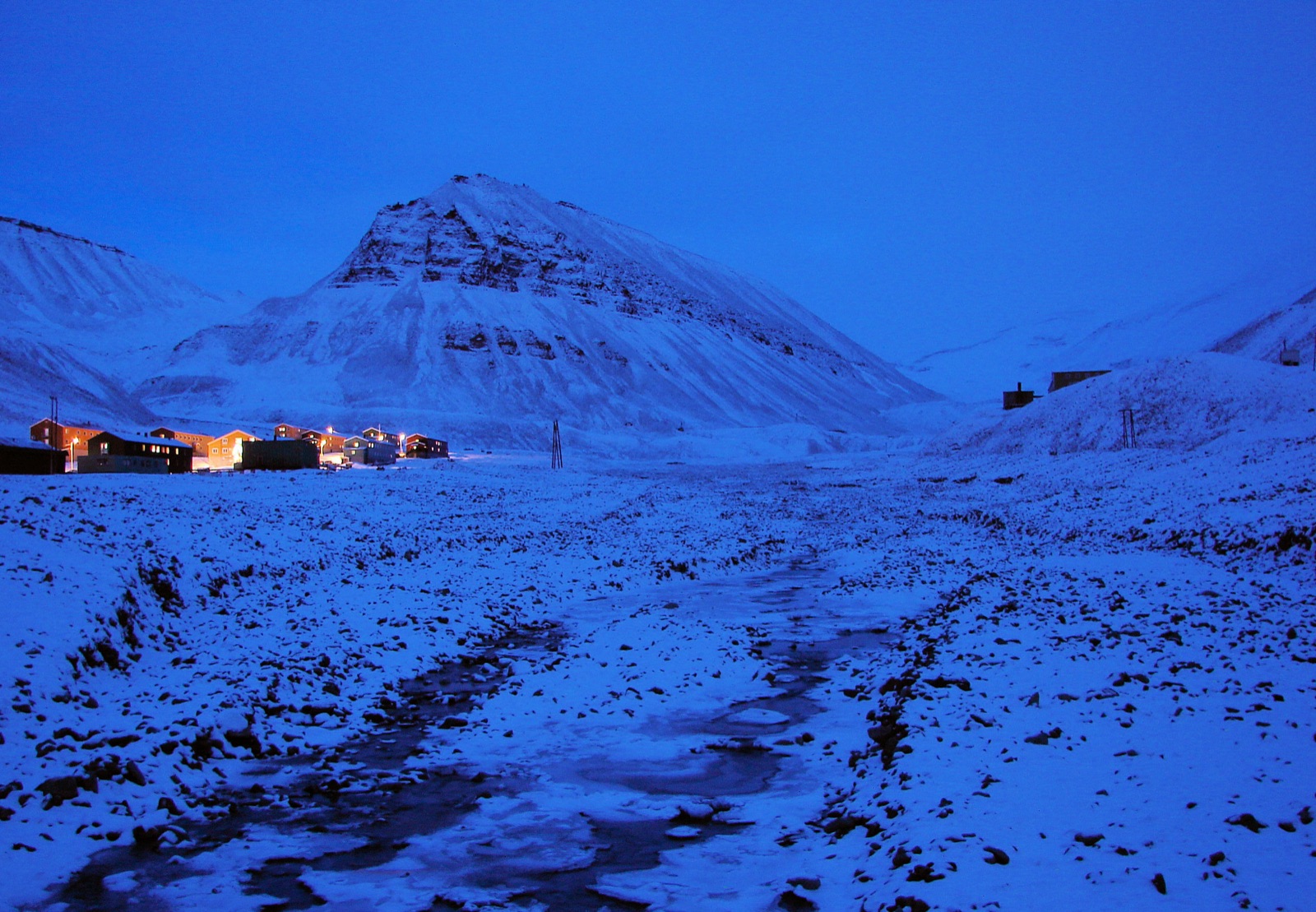
Photo: Bjørn Christian Tørrissen, CC BY-SA 3.0, via Wikimedia Commons.

The reach is wider than the Alps and Norway: the list also turns up Lazy Mountain in Alaska (125 days), a shadowed cove in Newfoundland (111), and a cluster of Slovenian valleys: anywhere a steep wall stands between a settlement and the low winter sun.
Lærdalsøyri (a fjord-head village of eleven hundred people on an arm of the Sognefjord, with no mirror and no press) comes within three days of Rjukan. And at number four sits the surprise that reframes the whole list.
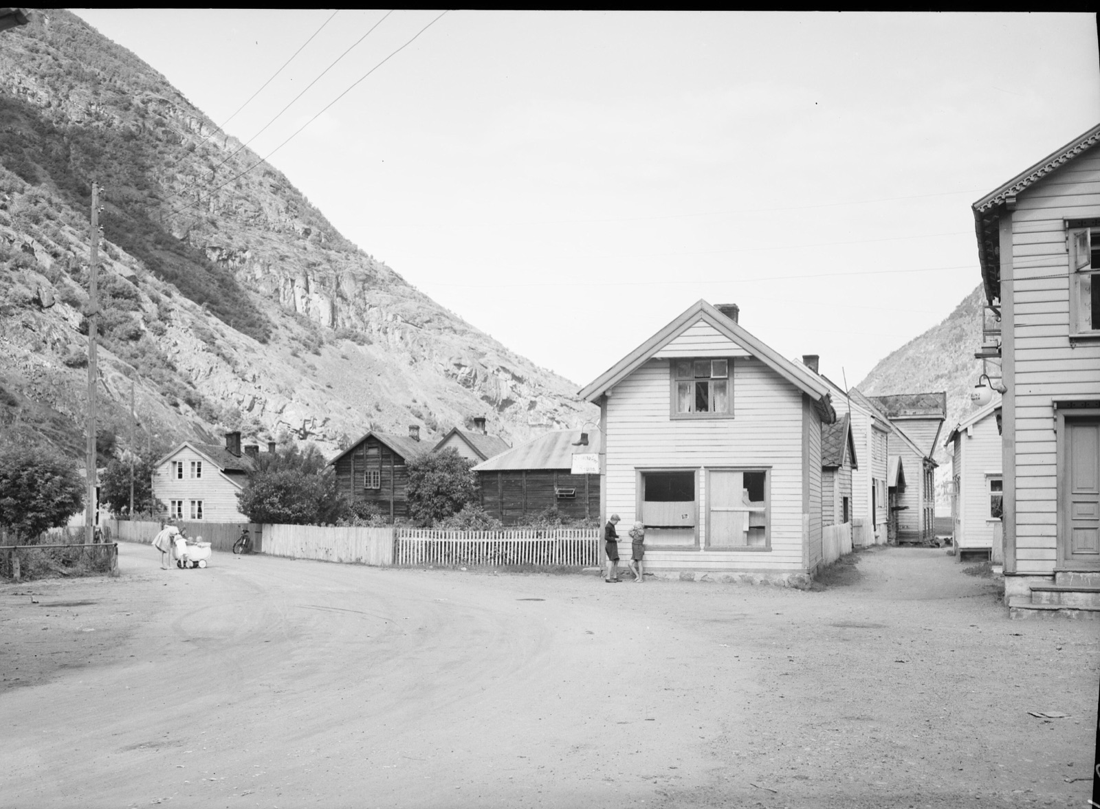
Photo: Nasjonalbiblioteket (National Library of Norway), public domain, via Wikimedia Commons (cropped).

The Alps hide their own Rjukans
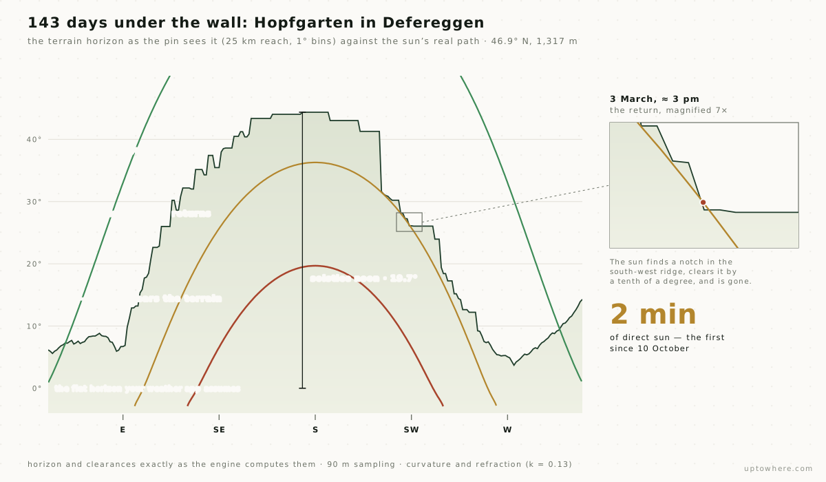
Hopfgarten in Defereggen is a village of 249 people in East Tyrol, at 1,317 metres, high up, where you would expect open sky. It loses the sun for 143 days a year: more than Bristen, more than Viganella, more than any Swiss village on the famous lists. It sits at 46.9° north (level with Bern) in the Defereggental, one of the deepest, narrowest east–west valleys in the Eastern Alps, under a southern wall that rises 44° into the sky. At the winter solstice the noon sun reaches only 19.7°. The wall wins by more than two to one, every day, for nearly five months. It has never made a single one of the famous lists.
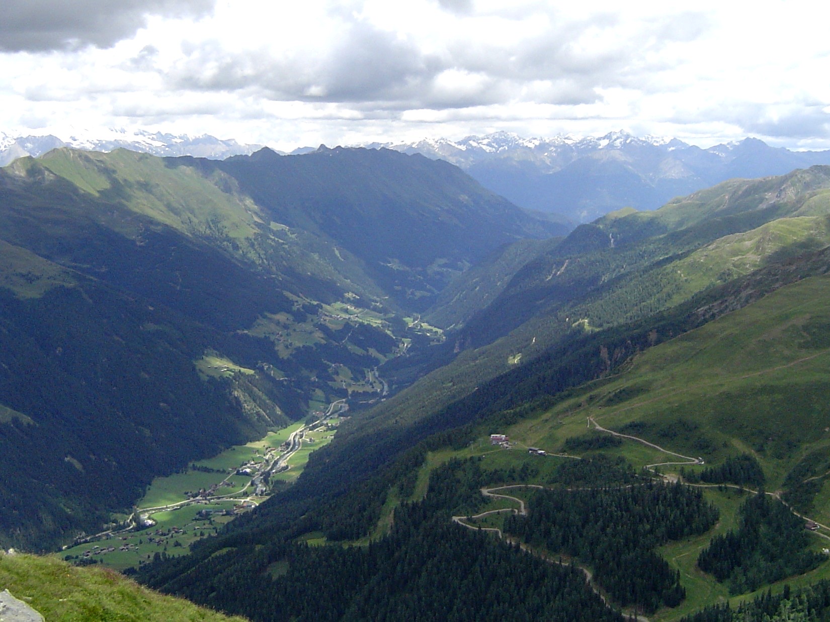
Photo: Itti, CC BY-SA 3.0, via Wikimedia Commons.

And the return, when it finally comes on 3 March, is not a sunrise. The sun slips through a notch in the south-west ridge at about three in the afternoon: two minutes of sun, 0.11° above the rock, and gone again. Margins like that decide every date on the leaderboard:
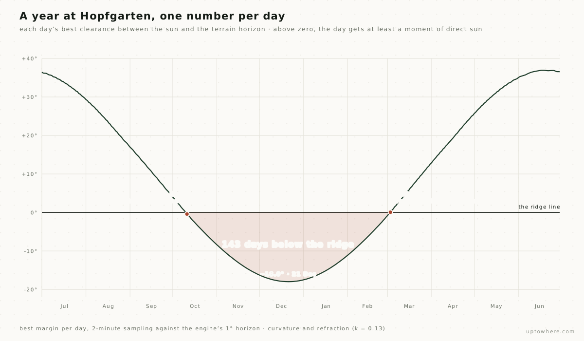
Run that same measurement for every day of the year and the sunless season stops being a claim and becomes an area. Each day has a single number (how far the sun's best moment clears the ridge, or fails to), and the stretch where that number stays below zero is the 143 days, drawn to scale:
It is not alone. Aigen bei Admont (Austria, 139 days), Lütschental (Switzerland, 136), Emmetten (132): a whole tier of Alpine villages between 46° and 48° north lose as much winter sun as places three hundred kilometres closer to the Arctic. They sit level with Geneva, Bern and Zürich; Les Andrieux, the French entry at 102 days, lies south of Lyon. The reason is not latitude: it is one mountain, in exactly the wrong place.
The famous names, on the same ruler
Measured the same way, the villages the newspapers have named mostly keep their reputations, with one wrinkle: each "village" is really one point in it:
| Village | Country | Published claim | Computed (centroid) |
|---|---|---|---|
| Rjukan | 🇳🇴 NO | "six months" | 177 days |
| Bristen | 🇨🇭 CH | ~139 days | 132 days |
| Rattenberg | 🇦🇹 AT | Nov–Feb | 94 days |
| Viganella | 🇮🇹 IT | 83 days | 93 days |
| Bondo | 🇨🇭 CH | 3–4 months | 90 days |
| Bosco Gurin | 🇨🇭 CH | 83 days | 80 days |
Every one lands within a couple of weeks of the number it has carried for years, the first time they have all been measured the same way. Rattenberg is the interesting case: its own famous claim was never a computed figure but a lived one, and our terrain model, from nothing but the shape of the Schlossberg above it, puts its sunless spell at 94 days, from 4 November until the sun clears the castle hill again on 6 February.
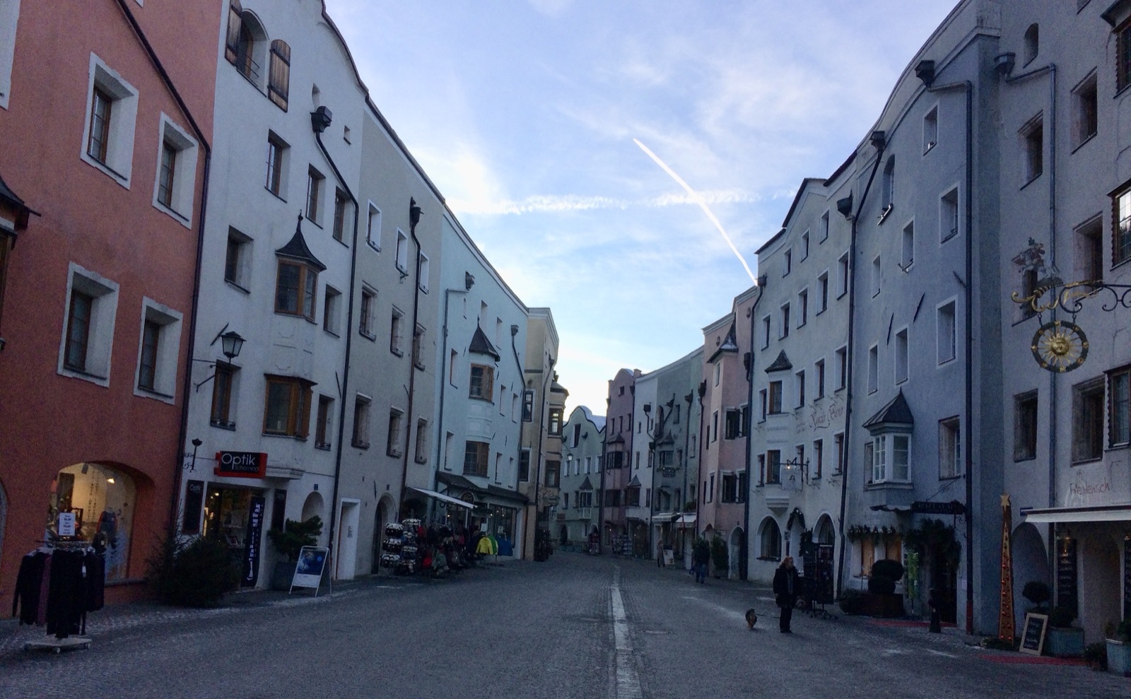
Photo: Dr Bob Hall, CC BY-SA 2.0, via Wikimedia Commons.
.jpg)
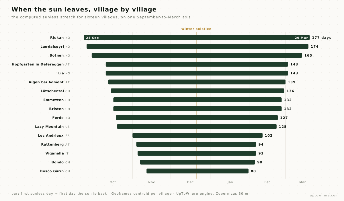
Put the whole cast on one time axis (the unknowns at the top of the leaderboard and the famous names below them), and the shape of the winter appears: the deeper the hole, the earlier the door closes and the later it opens.
Check your own valley
The mirror stories never give you the next step: finding out for your village, the chalet you are about to buy, or the campsite that goes cold at four in the afternoon.
Drop a pin anywhere on UpToWhere, run the analysis, and open the Sky tab. It computes the same thing this article does: the terrain-corrected sunrise and sunset for that exact point, the day the sun disappears behind the ridge, and how many days a year it never gets above it at all. The number is real data for your pin, not a sample.
Check any valley's winter sun, free
How we ran it
Everything above comes from the engine behind UpToWhere, on 30 m Copernicus GLO-30 elevation data, with Earth's curvature and standard atmospheric refraction in every ray. For each settlement we:
- Built a 360° horizon profile (the terrain elevation angle in every compass direction out to 25 km) from the elevation model around the point.
- Walked every day of a full year, and for each day found the moment the sun actually clears that horizon at dawn and drops behind it at dusk, by tracking the sun's true path against the profile. A day counts as sunless only when the sun fails to clear the terrain at both ends, never for a single missing sunrise, which just means the sun arrived after noon.
- Counted the sunless days and found the longest unbroken stretch: the "the sun left on this date and came back on that one" figure the villages themselves talk about. The dates we quote are the first day the sun fails to clear the terrain and the first day it clears it again.
One limit worth stating, because it shapes the list: the horizon profile reaches 25 km, so a very distant giant (a 4,000 m wall 40 km away) is not counted. In practice the mountain that takes a valley's sun is almost always the near one, and every famous case checks out, but a handful of places with a far southern rampart may lose slightly more sun than we credit.
We also ran the full method against the villages whose numbers are published (Rjukan, Viganella, Bristen and the Swiss list the press quotes), and it lands within a few days of each. The leaderboard is the same engine, pointed at the places nobody thought to check.
The full computed table
All 51 settlements the compute returned with 80 or more sunless days at their GeoNames centroid. Sort it, filter it, or open any village in the calculator with its pin already dropped. Dates are the first day the sun fails to clear the terrain and the first day it clears it again; elevations are what the 30 m model reports at the pin.
| Open | |||||
|---|---|---|---|---|---|
| 1 | Rjukan 🇳🇴NO | 295 m | 177 | 24 Sep → 20 Mar | Open |
| 2 | Lærdalsøyri 🇳🇴NO | 4 m | 174 | 26 Sep → 19 Mar | Open |
| 3 | Botnen 🇳🇴NO | 539 m | 165 | 30 Sep → 14 Mar | Open |
| 4 | Hopfgarten in Defereggen 🇦🇹AT | 1 317 m | 143 | 11 Oct → 3 Mar | Open |
| 5 | Lia 🇳🇴NO | 571 m | 143 | 11 Oct → 3 Mar | Open |
| 6 | Aigen bei Admont 🇦🇹AT | 677 m | 139 | 13 Oct → 1 Mar | Open |
| 7 | Lütschental 🇨🇭CH | 713 m | 136 | 15 Oct → 28 Feb | Open |
| 8 | Emmetten 🇨🇭CH | 762 m | 132 | 17 Oct → 26 Feb | Open |
| 9 | Bristen 🇨🇭CH | 787 m | 132 | 17 Oct → 26 Feb | Open |
| 10 | Førde 🇳🇴NO | 3 m | 127 | 19 Oct → 23 Feb | Open |
| 11 | Lazy Mountain 🇺🇸US | 823 m | 125 | 20 Oct → 22 Feb | Open |
| 12 | Alnes 🇳🇴NO | 7 m | 125 | 20 Oct → 22 Feb | Open |
| 13 | Grøa 🇳🇴NO | 46 m | 123 | 21 Oct → 21 Feb | Open |
| 14 | Grodås 🇳🇴NO | 55 m | 121 | 22 Oct → 20 Feb | Open |
| 15 | Tanay 🇨🇭CH | 1 421 m | 119 | 23 Oct → 19 Feb | Open |
| 16 | Gozd–Martuljek 🇸🇮SI | 808 m | 119 | 23 Oct → 19 Feb | Open |
| 17 | Mittewald an der Drau 🇦🇹AT | 1 104 m | 119 | 23 Oct → 19 Feb | Open |
| 18 | Silbertal 🇦🇹AT | 886 m | 119 | 23 Oct → 19 Feb | Open |
| 19 | Kvam 🇳🇴NO | 265 m | 117 | 24 Oct → 18 Feb | Open |
| 20 | Vincarje 🇸🇮SI | 407 m | 116 | 25 Oct → 18 Feb | Open |
| 21 | Sunndalsøra 🇳🇴NO | 7 m | 116 | 24 Oct → 17 Feb | Open |
| 22 | Farnes 🇳🇴NO | 11 m | 115 | 25 Oct → 17 Feb | Open |
| 23 | Årdalstangen 🇳🇴NO | 7 m | 115 | 25 Oct → 17 Feb | Open |
| 24 | Sandane 🇳🇴NO | 8 m | 115 | 25 Oct → 17 Feb | Open |
| 25 | Kohlstatt 🇦🇹AT | 503 m | 114 | 26 Oct → 17 Feb | Open |
| 26 | Winkl 🇦🇹AT | 552 m | 113 | 26 Oct → 16 Feb | Open |
| 27 | Gudvangen 🇳🇴NO | 12 m | 113 | 26 Oct → 16 Feb | Open |
| 28 | St. Bernard's-Jacques Fontaine 🇨🇦CA | 17 m | 111 | 27 Oct → 15 Feb | Open |
| 29 | Vik 🇳🇴NO | 659 m | 111 | 27 Oct → 15 Feb | Open |
| 30 | Sylte 🇳🇴NO | 4 m | 111 | 27 Oct → 15 Feb | Open |
| 31 | Zgornje Jezersko 🇸🇮SI | 988 m | 110 | 28 Oct → 15 Feb | Open |
| 32 | Partenen 🇦🇹AT | 1 177 m | 109 | 28 Oct → 14 Feb | Open |
| 33 | Mundal 🇳🇴NO | 24 m | 107 | 29 Oct → 13 Feb | Open |
| 34 | Dale 🇳🇴NO | 329 m | 107 | 29 Oct → 13 Feb | Open |
| 35 | Fossbergom 🇳🇴NO | 378 m | 107 | 29 Oct → 13 Feb | Open |
| 36 | Stampa 🇨🇭CH | 1 001 m | 105 | 30 Oct → 12 Feb | Open |
| 37 | Megolo di Mezzo 🇮🇹IT | 226 m | 103 | 31 Oct → 11 Feb | Open |
| 38 | Les Andrieux 🇫🇷FR | 1 046 m | 102 | 1 Nov → 11 Feb | Open |
| 39 | Megolo di Cima 🇮🇹IT | 221 m | 101 | 1 Nov → 10 Feb | Open |
| 40 | Miland 🇳🇴NO | 216 m | 101 | 1 Nov → 10 Feb | Open |
| 41 | Guggenoi-Digon 🇮🇹IT | 1 206 m | 100 | 2 Nov → 10 Feb | Open |
| 42 | Lezzeno 🇮🇹IT | 250 m | 99 | 2 Nov → 9 Feb | Open |
| 43 | Hüttendorf 🇦🇹AT | 968 m | 99 | 2 Nov → 9 Feb | Open |
| 44 | Schnann 🇦🇹AT | 1 167 m | 99 | 2 Nov → 9 Feb | Open |
| 45 | Tyssedal 🇳🇴NO | 42 m | 98 | 3 Nov → 9 Feb | Open |
| 46 | Valcanale 🇮🇹IT | 992 m | 98 | 3 Nov → 9 Feb | Open |
| 47 | Stechelberg 🇨🇭CH | 927 m | 98 | 3 Nov → 9 Feb | Open |
| 48 | Rattenberg 🇦🇹AT | 523 m | 94 | 4 Nov → 6 Feb | Open |
| 49 | Viganella 🇮🇹IT | 577 m | 93 | 5 Nov → 6 Feb | Open |
| 50 | Bondo 🇨🇭CH | 817 m | 90 | 7 Nov → 5 Feb | Open |
| 51 | Bosco Gurin 🇨🇭CH | 1 506 m | 80 | 12 Nov → 31 Jan | Open |
No village matches that.
Frequently asked questions
Which village gets the least winter sun?
Among sizeable towns, our computation puts Rjukan, Norway at the top: 177 days a year (nearly six months) with no direct sun at the town centre, from 24 September until the sun clears the ridge again on 20 March. It is closely followed by Lærdalsøyri (174 days) and Botnen (165), both in Norway and neither famous for it. The most surprising entry is Hopfgarten in Defereggen in Austria, which loses the sun for 143 days despite sitting level with Bern, far south of anywhere people associate with darkness. Smaller hamlets and spots higher up individual valleys can exceed even these: a single house on a shaded valley floor loses more sun than its village's centre.
How can a village get no sun for months if it's not in the Arctic?
It is the mountain, not the latitude. In winter the midday sun sits low even in the Alps, around 20° above the horizon at the solstice at 46° north. A ridge to the south that rises higher than 20° as seen from the valley floor blocks the sun at its highest point of the day, which means it blocks it all day, every day, until the sun climbs higher weeks later. A deep, steep-sided, roughly east–west valley is the perfect trap.
Is this the same as polar night?
No. Polar night, above the Arctic Circle, is when the sun stays below the flat horizon for the whole day because of the Earth's tilt, no mountain required. This is terrain shadow: the sun is above the flat horizon, but a mountain is in the way. A valley in the Alps at the latitude of Milan can lose the sun for months without ever seeing a polar night.
Does this account for buildings and trees?
No. It uses a bare-terrain elevation model, so it sees mountains and valleys but not buildings, walls or forest. That makes it accurate for open mountain villages (where the horizon really is the mountain) and unsuitable for cities, where the building opposite decides your sunlight.
How do I check my own village or house?
Open the UpToWhere calculator, drop a pin on the exact spot, run the analysis and open the Sky tab. It shows the terrain-corrected sunrise and sunset and the count of days per year with no direct sun, computed live from the same 30 m elevation data used for this article, for any point on Earth.