UpToWhere
What can you see from Kiyomizu-dera (Kyoto)?
Kyoto's sacred cascade: wooden temple without a single nail.
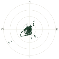
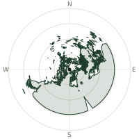
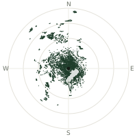
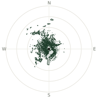
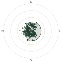
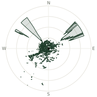
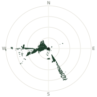
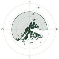
From Kiyomizu-dera (Kyoto), the terrain-limited line of sight reaches up to 95.1 km. The single farthest piece of visible terrain lies 95.1 km to the southwest (bearing 216°), at 331 m elevation. These results account for Earth's curvature and standard atmospheric refraction, computed from 30-meter resolution Copernicus GLO-30 elevation data across 1,885,259 terrain samples.
Open the interactive visibility map →Visibility by direction
The horizon is most open toward the south-southwest, where sightlines run 53.6 km on average; terrain closes the view down fastest to the east-northeast, at 0.1 km.
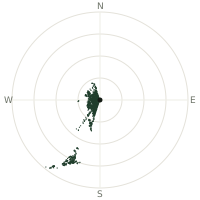
| N | 0.2 km | |
| NNE | 0.2 km | |
| NE | 0.2 km | |
| ENE | 0.1 km | |
| E | 0.1 km | |
| ESE | 0.2 km | |
| SE | 0.2 km | |
| SSE | 0.2 km | |
| S | 0.7 km | |
| SSW | 53.6 km | |
| SW | 31.2 km | |
| WSW | 15.2 km | |
| W | 13.7 km | |
| WNW | 16.0 km | |
| NW | 13.0 km | |
| NNW | 14.5 km |
Farthest named landmarks in view
10 named peaks, hills and headlands stand inside this viewshed. These are the farthest ones you could pick out on a clear day:
| Landmark | Visible distance | Direction | Elevation |
|---|---|---|---|
| Iimori Yama | 95.0 km | SW · 216° | 375 m |
| Manaitaishi Yama | 92.8 km | SW · 215° | 415 m |
| Mitsumine Yama | 83.3 km | SSW · 208° | 578 m |
| Katsuragi San | 78.7 km | SSW · 204° | 861 m |
| Iwao Yama | 75.0 km | SSW · 203° | 562 m |
| Kōno Yama | 72.6 km | SSW · 207° | 235 m |
About Kiyomizu-dera (Kyoto)
Kiyomizu-dera, founded 778 by Enchin Shonin at the Otowa Waterfall, stands as a testament to ancient Japanese carpentry. The entire structure uses no metal nails, relying instead on bamboo wedges and interlocking beams. Its famous wooden stage, supported by 139 pillars, exemplifies kakezukuri construction technique refined over centuries.
Did you know?
- Founded 778 CE in early Heian period by Enchin Shonin.
- Entire structure built without a single metal nail.
- Wooden stage uses 168 pillars; supported by 139 from below.
- Uses kakezukuri (overhanging) traditional construction technique.
- Current buildings reconstructed 1631-1633 by third Tokugawa Shogun Iemitsu.
Frequently asked questions
How far can you see from Kiyomizu-dera (Kyoto)?
On a clear day the terrain allows a line of sight of up to 95.1 km from Kiyomizu-dera (Kyoto). The average visible distance across all 360 directions is 9.9 km. Atmospheric conditions (haze, humidity) usually reduce practical visibility below the terrain-limited maximum.
What is the farthest point visible from Kiyomizu-dera (Kyoto)?
The farthest terrain visible from Kiyomizu-dera (Kyoto) lies 95.1 km to the southwest, at an elevation of 331 m. Earth's curvature and atmospheric refraction are accounted for in this calculation.
How high is Kiyomizu-dera (Kyoto)?
The observation point at Kiyomizu-dera (Kyoto) sits at 162 m above sea level (Copernicus GLO-30 elevation model).
How is this visibility map calculated?
UpToWhere traces lines of sight in 360 directions from the observer using 30 m-resolution Copernicus terrain data, correcting for Earth curvature and standard atmospheric refraction. You can run the same analysis for any point on Earth with the free calculator.
Run your own analysis
Want to know what you can see from your house, a summit you're planning to climb, or a plot of land? UpToWhere computes the same 360° viewshed for any point on Earth in seconds — free.
Try the viewshed calculator