 UpToWhere
To check a proposed radio link, enter both antenna sites, their heights and frequency in UpToWhere's free RF line-of-sight calculator. It draws the terrain profile, Earth curvature and first Fresnel zone so you can see where the path clears or fails before buying hardware.
Terrain in the path can stop a VHF contact, weaken a WISP connection or leave a repeater missing the next valley. A terrain check takes seconds and tells you whether a site survey is worth doing.
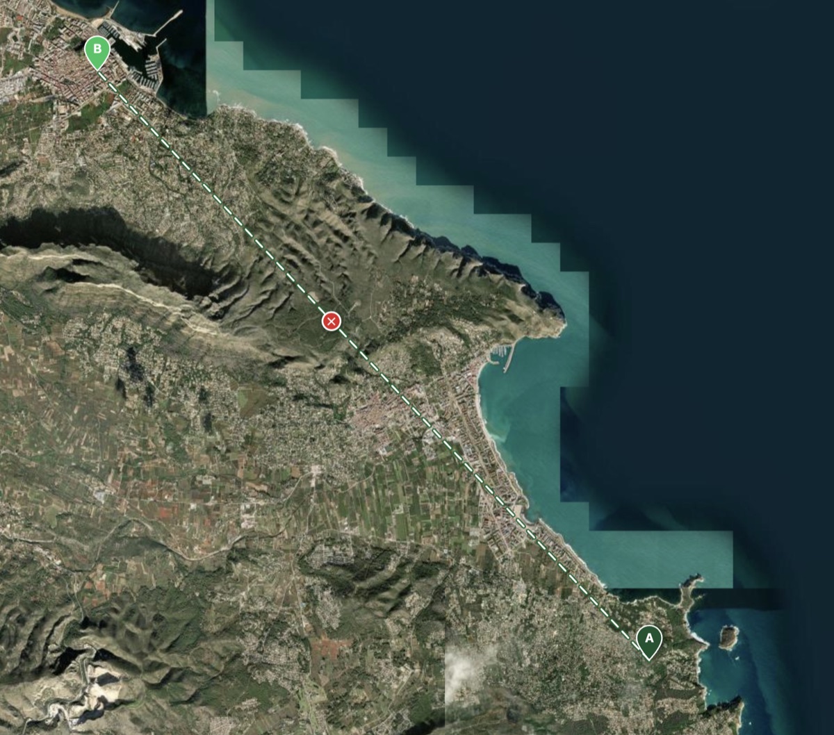
Take a real case from the Alicante coast: Xàbia and Dénia, two towns 13 km (8.1 mi) apart, with the 753 m (2,470 ft) Montgó massif sitting squarely between their antennas. It's the running example for the rest of this article.
The radio horizon is farther than the visual one
Radio waves refract downward in the atmosphere slightly more than light does. Engineers model this with the k-factor: under standard conditions radio behaves as if Earth's radius were 4/3 its real value. The practical result:
visual horizon  ≈ 3.57 × √h   [km, h in m]
radio horizon   ≈ 4.12 × √h
An antenna at 10 m (33 ft) reaches a radio horizon of ~13 km (8.1 mi); at 100 m (328 ft), ~41 km (25 mi). Two stations combine: a 10 m base and a 100 m repeater can theoretically work each other at ~54 km (34 mi), if nothing in between blocks the path. And that "if" is the whole game in hilly terrain.
Line of sight isn't a line: it's an ellipse
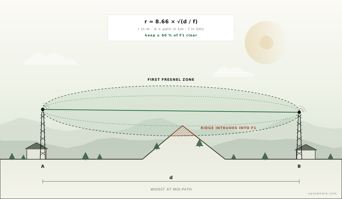
The second thing terrain can break is the Fresnel zone: the rugby-ball-shaped volume around the direct path that carries most of the signal energy. Obstacles that intrude into it attenuate the link even when they don't touch the geometric sightline. The first Fresnel zone's radius at mid-path is:
r ≈ 8.66 × √(d / f) [r in m, d = path length in km, f = frequency in GHz]
Rules of thumb that follow from it:
- Keep at least 60 % of the first Fresnel zone clear as a screening rule. ITU-R P.530 gives the clearance guidance used in fixed line-of-sight link design; a full design also considers fading and other propagation effects.
- Lower frequencies bulge more: on a 10 km (6.2 mi) path the first zone's mid-path radius is ~11 m (36 ft) at 5.8 GHz but ~72 m (236 ft) at 145 MHz. That grazing ridge that's fine for a microwave dish can eat a 2 m SSB path.
- Clearance matters most at mid-path, where the ellipse is fattest: a ridge halfway hurts more than the same ridge near either end.
Check any path in seconds
The free RF calculator reads approximately 30 m public terrain tiles in your browser and checks paths up to 150 km:
- Place point A at your station and point B at the far end: the repeater, customer roof or other antenna site.
- Set both antenna heights and the frequency, then check the terrain profile, line of sight and first Fresnel zone.
- If terrain intrudes, change the proposed site or antenna height and run the check again before buying hardware.
For coverage rather than a single link (where can my repeater be heard? which valleys does my node serve?), run a 360° viewshed from the antenna site as a first-order coverage map. The point-to-point example below comes from the main UpToWhere app, which also suggests antenna-height changes.
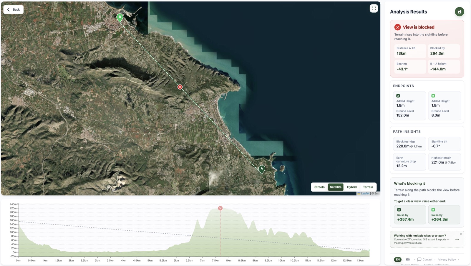
A note on scope: the free RF tool checks terrain line of sight and first Fresnel clearance, but it does not predict diffraction, ducting, vegetation loss, interference or a link budget. A 360° viewshed is an optical visibility screen, not a radio-coverage prediction. For WISP and fixed-wireless work with many candidate links, Studio checks first-Fresnel clearance across the network; for SCADA and telemetry, it can solve mast heights for blocked paths.

Check your radio link for free
Frequently asked questions
How far can a VHF/UHF signal travel?
For practical purposes, to the combined radio horizon of the two antennas: roughly 4.12 × (√h₁ + √h₂) kilometres with heights in metres. Two handhelds at head height manage about 10 km (6.2 mi) over flat ground; a base station working a mountain-top repeater can span well over 100 km (62 mi), terrain permitting.
What is the difference between visual and radio line of sight?
Radio waves refract downward more than light, so the radio horizon lies about 15 % farther than the visual one (the 4/3-Earth or k-factor model). However, radio links also need Fresnel-zone clearance around the direct path, so a path that is barely visually clear can still perform poorly.
How much clearance does a radio link need?
The standard rule is at least 60 % of the first Fresnel zone free of obstacles. The zone's mid-path radius grows with path length and shrinks with frequency: long, low-frequency paths need tens of metres of clearance above the terrain.
Can I check radio line of sight online for free?
Yes. The free RF calculator checks point-to-point terrain line of sight, curvature and first Fresnel clearance without an account, for paths up to 150 km. The main UpToWhere calculator can also map 360° terrain visibility from an antenna site.