 UpToWhere
Under both European (EASA Open category) and US (FAA Part 107) rules, the default legal envelope for flying a drone is VLOS, visual line of sight: you (or a visual observer next to you) must be able to see the aircraft with the naked eye at all times. BVLOS flying (beyond visual line of sight) still requires waivers today; the FAA's dedicated framework (Part 108) is in rulemaking, with a final rule expected around 2026–2027.
Most pilots think of VLOS as a distance problem: how far away can I still see a 30 cm quadcopter? But in real landscapes, VLOS usually breaks for a different reason: terrain gets in the way. And where your eyes lose the drone behind a ridge, your control link often dies with them, because 2.4/5.8 GHz radio is line-of-sight too.
The terrain shadow: where flights go wrong
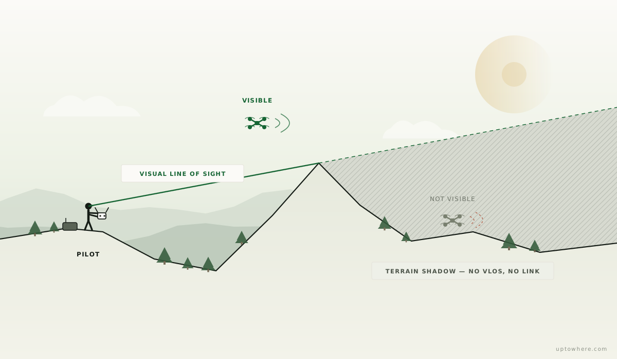
Fly from a valley floor and the world around you is full of invisible zones: behind every ridge, spur and treeline there's a wedge of airspace you cannot see into, a terrain shadow. Drop into one and three things happen at once:
- You lose visual contact (a legal problem),
- the control link degrades or drops (an RTH event, if you're lucky),
- and the video feed goes with it, so you can't even see what the drone sees.
The infamous version of this is flying over a ridge to "just check what's on the other side": the moment the drone descends past the crest line, it's in your shadow, on its own.
A viewshed is literally a VLOS map
A viewshed analysis computes exactly which terrain is visible from a point, which makes it a map of where your VLOS extends before you drive out:
- Open the free calculator and drop the pin on your planned launch/pilot position (set the observer height to your eye level).
- The visible area on the map is where you can legally and practically operate; every dark zone is a terrain shadow where both eyes and radio will struggle.
- Compare a couple of candidate launch points: a spot 50 m (164 ft) higher or 200 m (656 ft) to the side often converts an entire hidden valley into covered airspace.
- For a specific shot ("can I see the drone when it's over the waterfall?") use point-to-point mode between the pilot position and the target location at flight altitude.
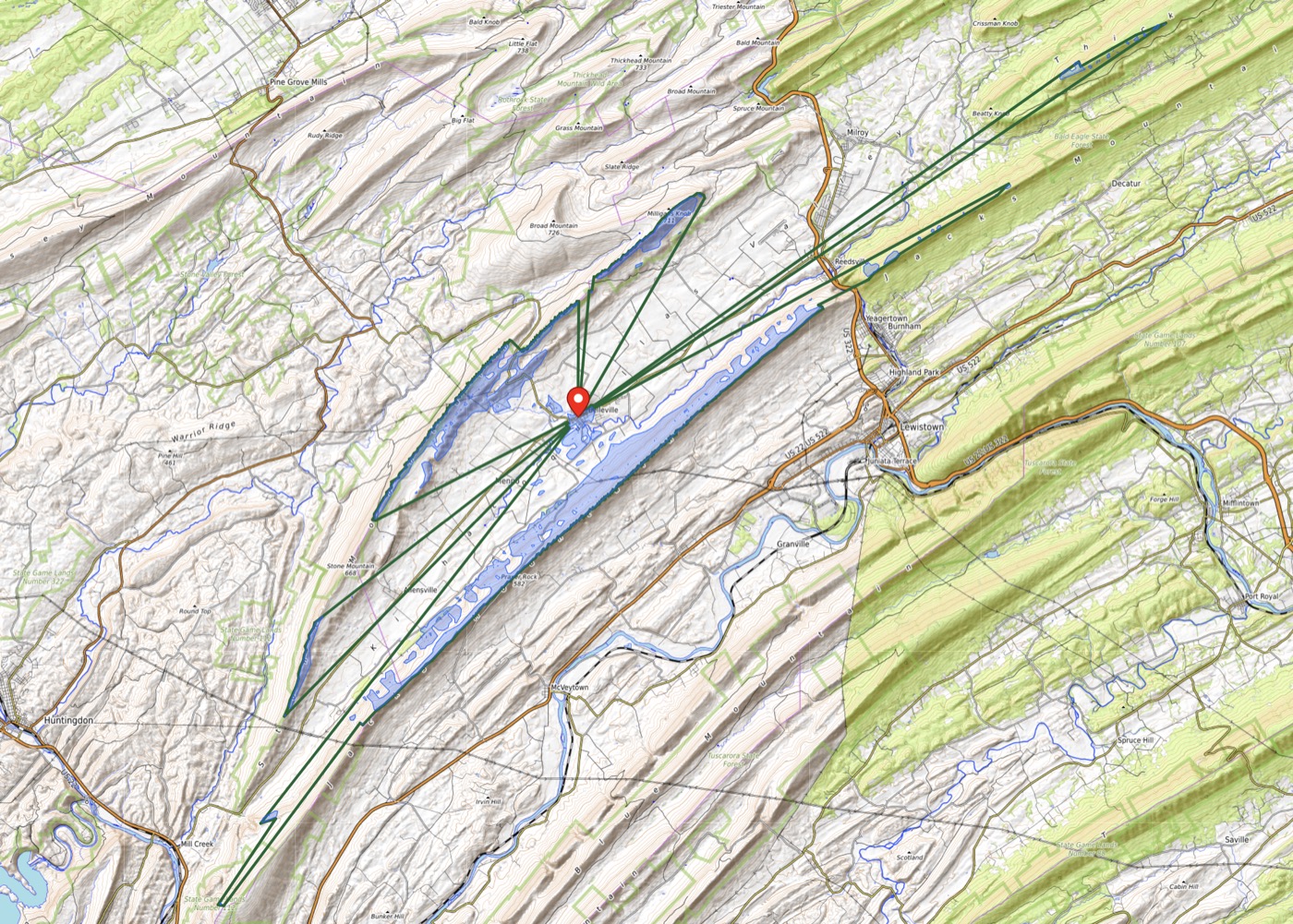
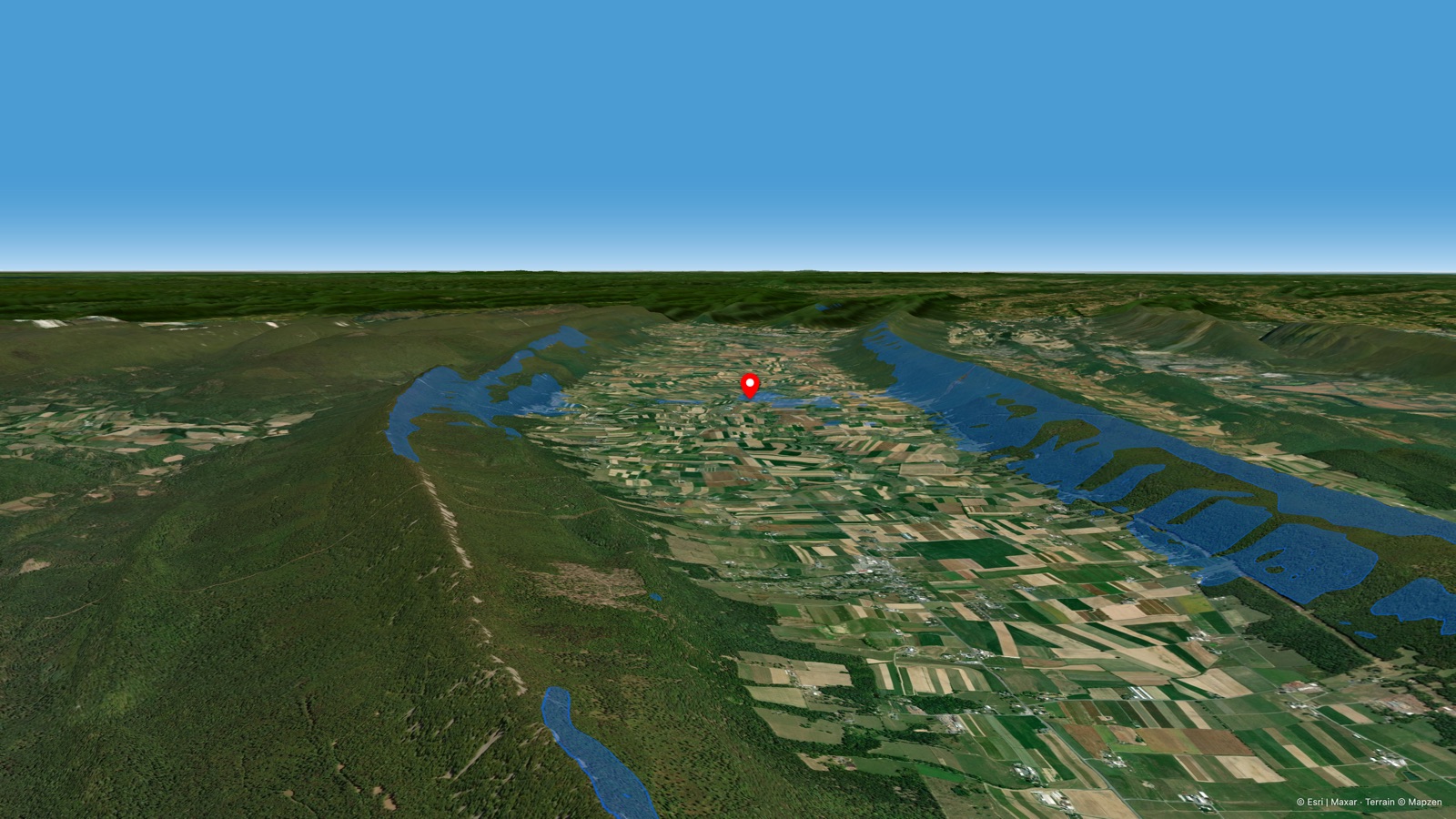
Take Pennsylvania's Big Valley as an example: a long, parallel ridge-and-valley landscape, exactly the repeating terrain that trips up VLOS. Launch from the valley floor near Belleville and the visible area hugs the valley itself, with a few thin sightlines slipping through wind gaps to the ridgelines beyond. Everywhere else behind those ridges is a terrain shadow.
Two practical notes:
- Altitude helps the drone, not you. The drone climbing higher escapes radio shadow eventually, but VLOS is about your eyes: a drone 500 m (1,640 ft) up behind a ridge crest may be technically visible, while one 80 m (262 ft) up in the same spot is not. When comparing spots, what you want is open sightlines at your typical operating altitude, not at 120 m ceiling only.
- Distance still caps everything. Even with perfect geometry, a sub-25 kg drone stops being genuinely "visible unaided" somewhere in the 300–600 m (984–1,969 ft) range depending on size, contrast and light. Terrain analysis tells you where geometry fails first; regulations and common sense cap the rest.
The same map is your signal map
Because control and video links at 2.4/5.8 GHz behave optically over these distances, the viewshed doubles as a first-order RF coverage map: clear visual sightline ≈ healthy link; grazing sightline ≈ marginal link; terrain-blocked ≈ dropout. (For long-range fixed installations like FPV repeaters, see our radio line of sight guide; Fresnel clearance starts to matter there.)
Pick the launch point where the viewshed covers your whole planned flight path, and you've simultaneously solved the legal problem, the signal problem, and the "why is it not coming back" problem.
Map your VLOS from any launch point, free
If you are planning BVLOS rather than VLOS, Studio maps terrain shadow at cruise altitude across a set of launch points.
Frequently asked questions
What does VLOS mean in drone rules?
Visual line of sight: the remote pilot (or a co-located visual observer) must be able to see the drone directly with unaided vision throughout the flight. It is the default requirement of the EASA Open category in Europe and FAA Part 107 in the United States; flying beyond it (BVLOS) requires specific authorization.
How far away can you legally fly a drone under VLOS?
The rules define no fixed distance: the requirement is that you can actually see the aircraft. In practice a typical consumer drone stops being visible to the naked eye at roughly 300–600 metres (984–1,969 ft) horizontally, and much less against a bright sky or in haze. Terrain can end VLOS far sooner than distance does.
Why does my drone lose signal behind hills?
Control and video links at 2.4 and 5.8 GHz are effectively line-of-sight. When terrain blocks the straight path between you and the drone, the link attenuates sharply or drops, typically triggering return-to-home. A viewshed analysis from your pilot position shows these blocked zones before you fly.
Is BVLOS flying legal yet?
Only with case-by-case waivers or specific authorizations today. In the US, the FAA's proposed Part 108 rule for routine BVLOS operations completed public comments and is expected to be finalized around 2026–2027; in Europe, BVLOS operates under the Specific category with an operational authorization. Check current regulations before planning any BVLOS operation.