 UpToWhere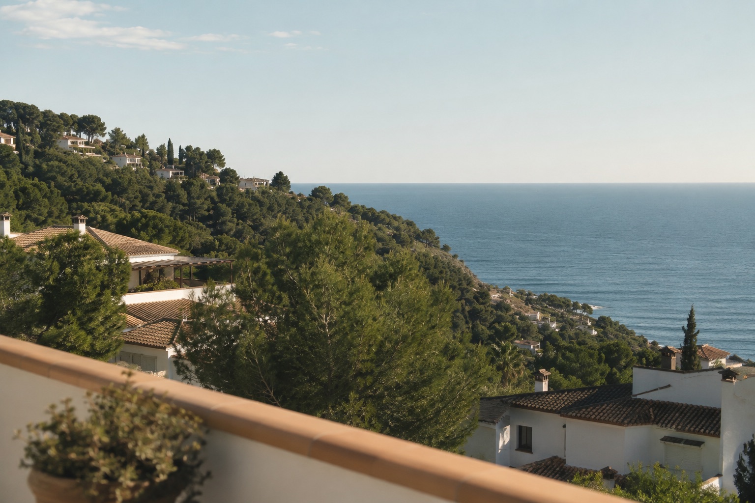
Before paying for a sea or mountain view, put the property in UpToWhere's free 360° visibility calculator and set the observer height for the floor you would use. Within its 20 km radius, the map shows which directions the terrain leaves open. It cannot settle what a nearby tree or building blocks, so verify those obstacles from the property itself.
Few words in a listing carry more weight than "sea views." A study of more than 20,000 home sales in Bellingham, Washington found that the value of a water view varies with its scope, distance and the housing market. A listing's partial sea views or sea glimpses still leaves the buyer with the practical question: what is visible from this exact floor?
One hazy afternoon visit can miss a distant view. The terrain check shows the geometry in minutes; a site visit catches nearby obstructions.
What a terrain analysis can tell you before you visit
A viewshed analysis computes every line of sight from a point, using elevation data, Earth's curvature and atmospheric refraction. Applied to a property decision it answers, with numbers:
- Is the sea geometrically visible at all from the house's position and height, or does that ridge between you and the coast close the line?
- How wide is the water horizon: a 90° panorama or a 4° slot between two hills?
- Which floor clears a ridge. Raising the observer height floor by floor shows whether a higher flat gains a terrain sightline toward the water. Check buildings and other nearby obstacles from each floor.
- Which distant landforms are visible: the mountain across the bay or a headland the listing photos missed.
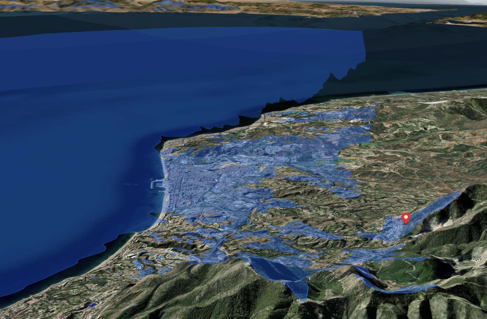
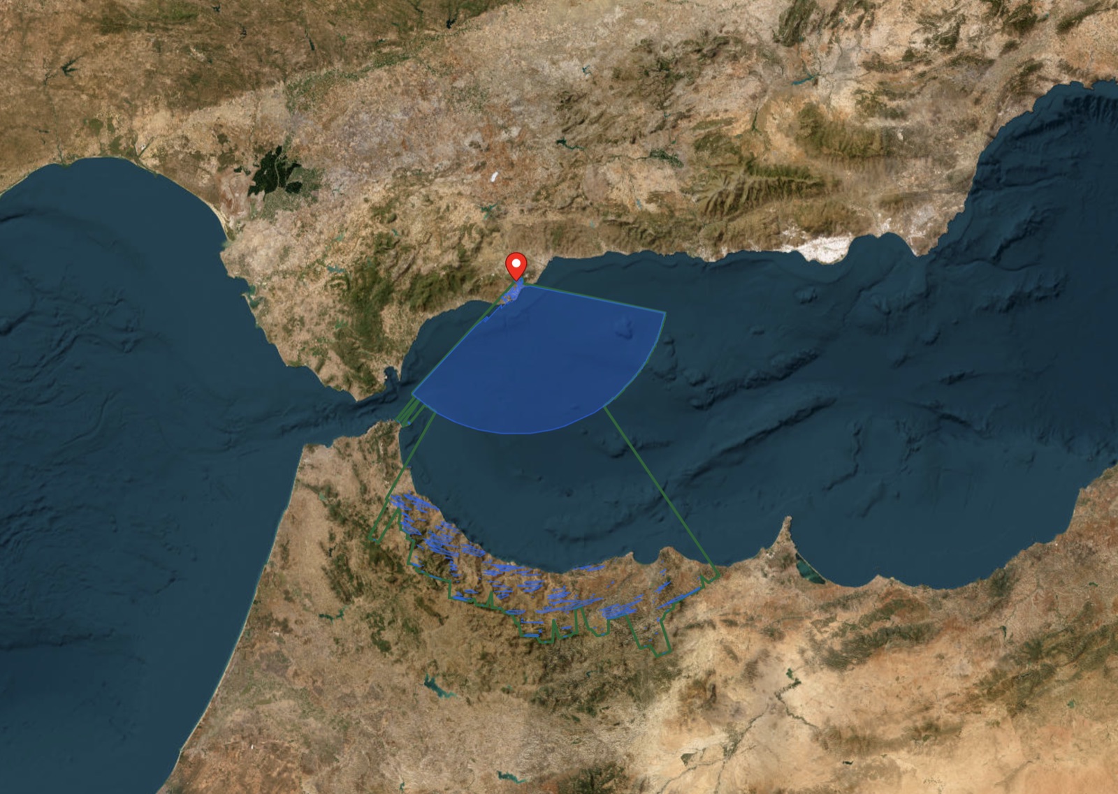
Take a real hillside above the Costa del Sol, near Mijas. With Pro's extended radius, the analysis shows a wide fan of Alboran Sea out to the open-water horizon and, rising beyond it, the crests of Morocco's Rif mountains some 160 km (100 mi) away. The free 20 km check covers the nearby coast; this long-range example needs Pro. The calculation establishes a terrain sightline, while weather determines whether the distant mountains can actually be seen.
How to run the check
- Open the free visibility calculator and place the observer exactly on the property; satellite view makes rooftops easy to hit.
- Set the observer height to the relevant floor: ground floor ≈ 2 m (6.6 ft), each storey ≈ 3 m (9.8 ft). A fourth-floor balcony is ~14 m (46 ft). Run it once per candidate floor.
- Read the result toward the water: within 20 km, the visible-area map shows which sectors reach the sea and which are blocked by terrain.
- For one specific promise ("you can see the lighthouse / the rock of Ifach / Mallorca on clear days"), use Pro point-to-point mode between the balcony and the landmark. It returns a yes/no with the terrain profile in between, including where the line clears or fails.
The same free 360° check helps with mountain and valley views. A planned building requires a separate check against its plans: the terrain model cannot predict a future structure.
The honest limits
Elevation data has a 30 m (98 ft) resolution: it is useful for terrain and big ridges, but it cannot reliably resolve individual buildings, trees or a future development. Treat the analysis as the terrain ceiling of the view: if terrain blocks the sea, a site visit cannot change that; if terrain clears, verify nearby obstacles with your own eyes, ideally from the actual floor, not the street.
For plots and rural land, where near-field obstacles are fewer, the terrain analysis is close to the full answer, and running it costs nothing, unlike discovering the problem after the deed is signed.
Check a property's real view, free
Frequently asked questions
Can I check the view from a specific floor of a building?
Yes: set the observer height to that floor's approximate elevation above ground (about 3 m / 9.8 ft per storey plus 1.5 m / 4.9 ft of eye height) and run the analysis from the building's position. Comparing runs at 5 m, 11 m and 17 m (16 ft, 36 ft and 56 ft) shows which floor first clears a terrain ridge. Check nearby buildings separately.
Does the analysis include buildings, or only mountains?
The 30 m (98 ft) elevation model is for terrain visibility. It cannot reliably include buildings or vegetation. Use it to check whether the sea is reachable over the terrain, then inspect nearby obstacles in person.
Can I verify a claim like "you can see Ibiza on clear days"?
Yes, with UpToWhere Pro's point-to-point check. It shows whether the line between the property and the target clears the terrain and curvature, with an elevation profile along the path. The free 360° map can screen the first 20 km in that direction. Distant-island claims may turn out to be true only from the roof, or only in the brochure.
Is this only for buyers?
Sellers and agents use the same analysis in reverse: a verified, mapped view ("the terrace sees 140° of open Mediterranean, confirmed by terrain analysis") is a stronger claim than an adjective, and it costs nothing to produce.